
SuperGIS Desktop 10.1 Help
The help provides the introduction to the manipulation of SuperGIS Desktop 10.1. In addition to viewing the contents by clicking the table of contents, users can also input keyword in Search and Index to find the related information.
The help includes the following topics:
•Brief of SuperGIS Desktop 10.1
•Setting and Managing Graphics
•Customizing SuperGIS Desktop 10.1
•Localizing User Interface and Data

SuperGIS Desktop 10.1 LiDAR Tool Help
The help provides the introduction to the manipulation of SuperGIS Desktop 10.1 LiDAR Tool. Users can input keyword in Search and Index to find the related information.
SuperGIS Desktop 10.1 Temporal Slider Help
The help provides the introduction to the manipulation of SuperGIS Desktop 10.1 Temporal Slider. Users can input keyword in Search and Index to find the related information.
SuperGIS Desktop 10.1 Mapnote Tool Help
The help provides the introduction to the manipulation of SuperGIS Desktop 10.1 Mapnote Tool. Users can input keyword in Search and Index to find the related information.
Mapnote Tool is a new add-on in SuperGIS Desktop 10.1. Mapnote is a layer in SuperGIS Desktop for storing texts on map: It stores the text placement, text string and text symbology, and users are able to edit them. Through Mapnote Tool, users can edit text on map flexibly and provide more readable maps.
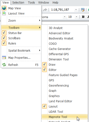
To use Mapnote tool, you can right-click on any space of toolbar of SuperGIS Desktop and then select “Mapnote Tool”. The Mapnote Tool toolbar will pop-up. Or, you can also open Mapnote Tool by clicking “View” > “Toolbars” on the toolbar of Desktop.
SuperGIS Desktop 10.1 Dimension Tool
A map cartographer might utilize map elements such as scale, compass, legend, etc. to enable map users to comprehend what the map conveys. Due to that map categories include ordinary map as well as land parcel map, cadastral map and many other theme maps, parts of maps use dimension line annotation that indicate distance between two features or side length of any specified feature. To do so, SuperGIS Desktop adds Dimension tool-to indicate feature length and distance-and Dimension classes-a special text layer. With Dimension tool and Dimension classes, users can generate diverse dimension features, including aligned dimension feature, simple aligned dimension feature, linear dimension feature, continue dimension feature, and so on. The following sections introduce Dimension tool, Dimension classes and each dimension feature.
©2015 Supergeo Technologies Inc. All rights reserved.