The Interface and Functions
SuperGIS DataConvertor meets users’ needs more. In the new version, the interface and multiple detailed functions are redesigned, so the manipulation is significantly improved. Meanwhile, the conversions of vector data, raster data, and NRT data are integrated in order to offer users a more complete data conversion environment.
Conversion Mode
The block for mode selection provides 3 types of conversion, Vector Data, Raster Data, and NRT Data and enables you to convert vector data, raster data, NRT data easily with SuperGIS DataConvertor.
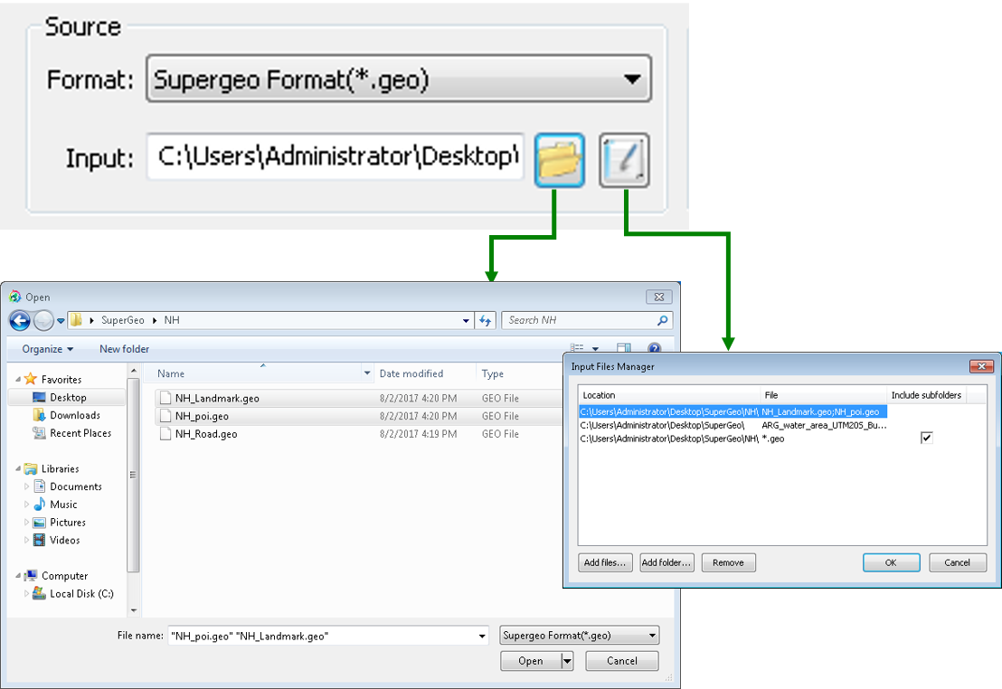
Source
SuperGIS DataConvertor can convert a single file or convert multiple files in the same format in batch processing. In Source, you can choose the format of the input file. The buttons to open files and implement Input Files Managers are provided. The former allows users to add a single or multiple files in the same file format; the latter offers the advanced input file management, like adding or deleting files and folders. Also, you can enter the file name or the path to add the file in Input.
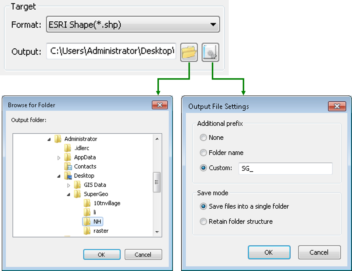
Target
SuperGIS DataConvertor not only adds the batch processing in Input but also redesign the target file processing. In Target, you can choose the format of the input file. The buttons to open files and implement Output Files Settings are provided. The former enables users to choose the path for saving files; the latter offers two types of settings, Additional Prefix and Save Mode to satisfy most of the needs in outputting files. In Output, you can directly enter the path for saving the file.
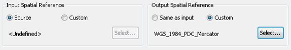
Input & Output Spatial Reference
To set the spatial reference of input and output file is an important function in SuperGIS DataConvertor. When you are converting data, you can convert the spatial reference at the same time. You can choose either No change to keep the same spatial reference of the input file or choose Other to set the spatial reference of input and output files.
Tool Buttons
Tool buttons are located at the lower-right corner of the window. Settings button offers the advanced conversion settings. Clicking Convert is to start converting. Review log button can open the conversion log file for you to review. Clicking Help button is to open SuperGIS DataConvertor Help. Clicking Exit can close the program.
© 2017 SuperGeo Technologies Inc. All Rights Reserved. |