Setting Spatial Reference
When you are applying SuperGIS DataConvertor to convert data, you can convert the spatial reference of input and output file at the same time.
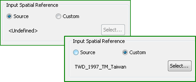
In the block for Input Spatial Reference, you can choose either No change or Other to set a new spatial reference coordinate system.
If you choose to use the spatial reference coordinate system of the input file, but no spatial reference is defined to the input file, Undefined will be displayed in SuperGIS DataConvertor. If you choose to set new spatial reference, you can click Select button to choose the coordinate system you need.
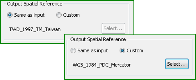
As to Output Spatial Reference, you can choose the same spatial reference as the input file (Same as Input) or to set a new coordinate system (Other).
If you choose to use the same spatial reference as the input file, the coordinate of the output file will be the same as the input file and will be displayed on the block for Output Spatial Reference. If you choose to set new spatial reference, you can click Select to choose the coordinate system you need.
© 2017 SuperGeo Technologies Inc. All Rights Reserved. |