
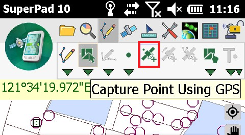
Capture Point Using GPS
To capture point using GPS, you should ensure a point layer is editable, and the Point button presents usable status in full colors. Capture Point Using GPS is to add a point feature at the current GPS position.
1.First connect GPS with your mobile device or ensure the GPS settings of your mobile device.
2.After the positioning successes, tap the GPS button on the main toolbar, switch to GPS toolbar; tap Turn On GPS on the toolbar and you will see the GPS cursor as ![]() shows, which represents the GPS position. On toolbar, Capture Point Using GPS displays usable status now, tap the Capture Point Using GPS button on the tool menu.
shows, which represents the GPS position. On toolbar, Capture Point Using GPS displays usable status now, tap the Capture Point Using GPS button on the tool menu.
3.Message box shows up. If you are sure to add the feature, tap Yes; if not, tap No.

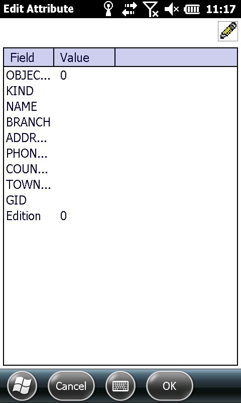
4.“Edit Attribute” dialog box shows up, in which you can create the attribute data for the new feature. After attribute data is accomplished, tap OK.
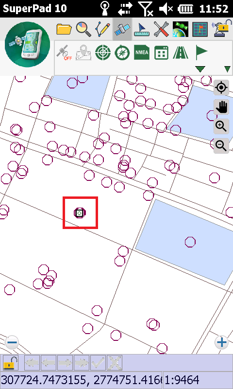
5.And you will see the created point feature on the map.
NOTE: when you want to run the GPS related functions, please turn on GPS first and ensure positioning works well. Thus, the related functions can work.
© 2017 Supergeo Technologies Inc. All Rights Reserved.