Selecting Input File
After the conversion mode is selected in SuperGIS DataConvertor, you need to choose the file format before choosing the input file. The Format dropdown lists in Source and Target will display different contents as you change the conversion mode.
In terms of vector data, SuperGIS DataConvertor supports to convert 10 types of input formats, such as *.geo, *.e00, *.sef, *.shp, *.mif, *.kml, *.gml, *.dxf, *.dwg, and *.dgn and supports 9 types of output formats, including *.geo, *.sef, *.shp, *.mif, *.kml, *.gml, *.dxf, *.dwg, and *.dgn. When you choose *.geo defined by SuperGeo Technologies as input format, the output format will display the rest 8 vector formats. If you choose oen of the other 10 vector formats, not *.geo as input format, the output format will display *.geo only.
If you choose Raster Data as the conversion mode, the situation is similar. When the format, *.sgr, defined by SuperGeo Technologies is selected as the input format, the output format will display the other 3 raster formats and ASCII File (*.txt) . On the other hand, if you choose one of the rest 8 or ASCII File (*.txt) for input file, not *.sgr, the output format will display *.sgr only.
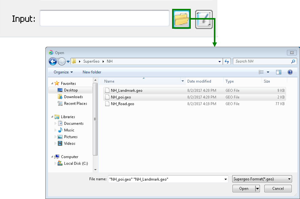
As the format of input and output file is selected, you can click Open button in Input to add one or more than one file in the same format to SuperGIS DataConvertor.
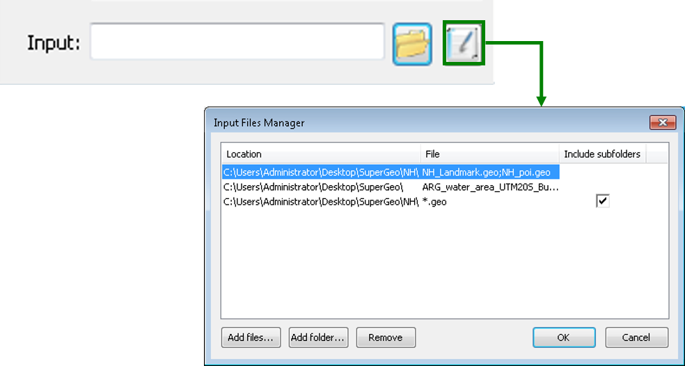
You also can click Input Files Manager button to open Input Files Manager window to add files in different location or folders or to do advanced output file management.
Of course, you can key in the path and the name of the file in Input, but please make sure the correctness of the path and file name. Otherwise, SuperGIS DataConvertor may not deal with your settings and will show a warning message to remind you before converting the file.
© 2017 SuperGeo Technologies Inc. All Rights Reserved. |