Setting Output File
After selecting the input file, you need to decide the format of the output file and the location for saving the file. The contents of Format in Target are the same as in Source. The contents will be changed according to the conversion mode you choose.
If you choose Vector Data or Raster Data, the Format dropdown list containing 2 types of contents will display either type of contents according to the format of output file. If you choose NRT Data, the Format dropdown list in Output only contains NRT or WGT all the time.
In terms of Vector Data, SuperGIS DataConvertor supports 10 input formats, like *.geo, *.e00, *.sef, *.shp, *.mif, *.kml, *.gml, *.dxf, *.dwg, and *.dgn. The output formats support *.geo, *.sef, *.shp, *.mif, *.kml, *.gml, *.dxf, *.dwg, and *.dgn. When *.geo, defined by SuperGeo Technologies, is selected as the input format, the output formats will only display the other 8 vector formats, except *.geo. If you choose a vector format, not *.geo, the output format dropdown list will include *.geo only.
If you choose Raster Dataas the conversion mode, the situation is similar. When the format, *.sgr, defined by SuperGeo Technologies is selected as the input format, the output format will display the other 3 raster formats and ASCII File (*.txt) . On the other hand, if you choose one of the rest 8 for input file or ASCII File (*.txt) , not *.sgr, the output format will display *.sgr only.
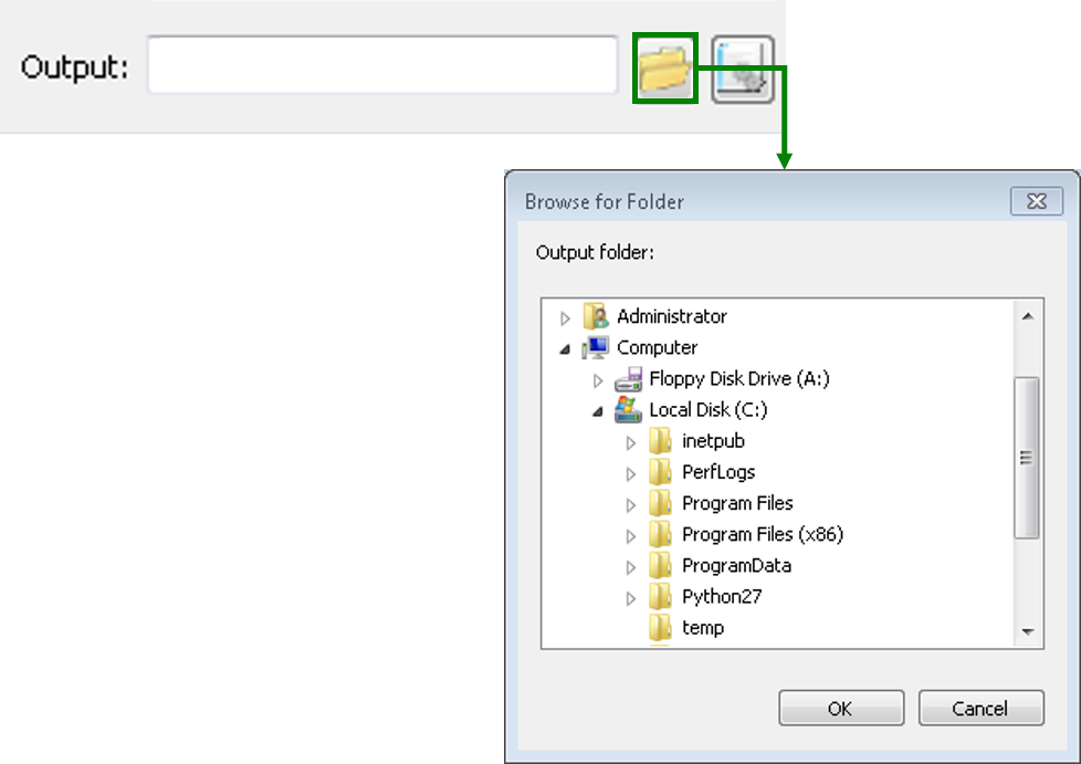
In the block for Output, you can click the Browse for folder button to select the folder for saving the output file.
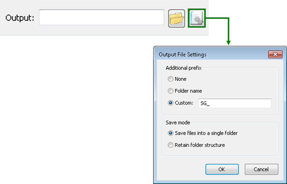
In addition, clicking Output File Settings enables you to set the advanced settings for the output file, like adding Additional prefix to the name of the output file and choose the Save mode for saving the output file. Thus, you can convert quantities of files more effectively.
Also, you can key in the path for saving the file in Output, but please make sure the correctness of the path. Otherwise, SuperGIS DataConvertor might not be able to deal with your settings and will show the warning message to remind you before converting the data.
© 2017 SuperGeo Technologies Inc. All Rights Reserved. |