
GPS Positioning
GPS Positioning allows to place GPS current position to the map center according to the current scale. The function only works when GPS is used. If you have not used GPS, please refer to Whether to Use GPS. After GPS positioning works successfully, you can see the coordinates of the current position on the GPS status bar on the top of the map.
1. Tap GPS positioning on the toolbar.

2. According to the current scale of the map, SuperSurv pan the GPS position to the map center. The GPS status bar displays the coordinates of the current position. You can tap the blank of the bar to switch longitude and latitude to projected coordinate system and GPS status.
You can also have GPS show your current position and GPS position remain in map center.
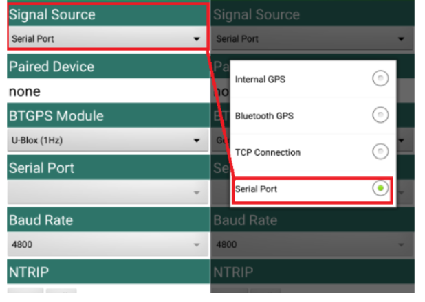
1. Users can choose a GPS signal through GPS Settings. You can setup the detailed positioning data source you need, and SuperSurv is using Internal GPS signal as default.
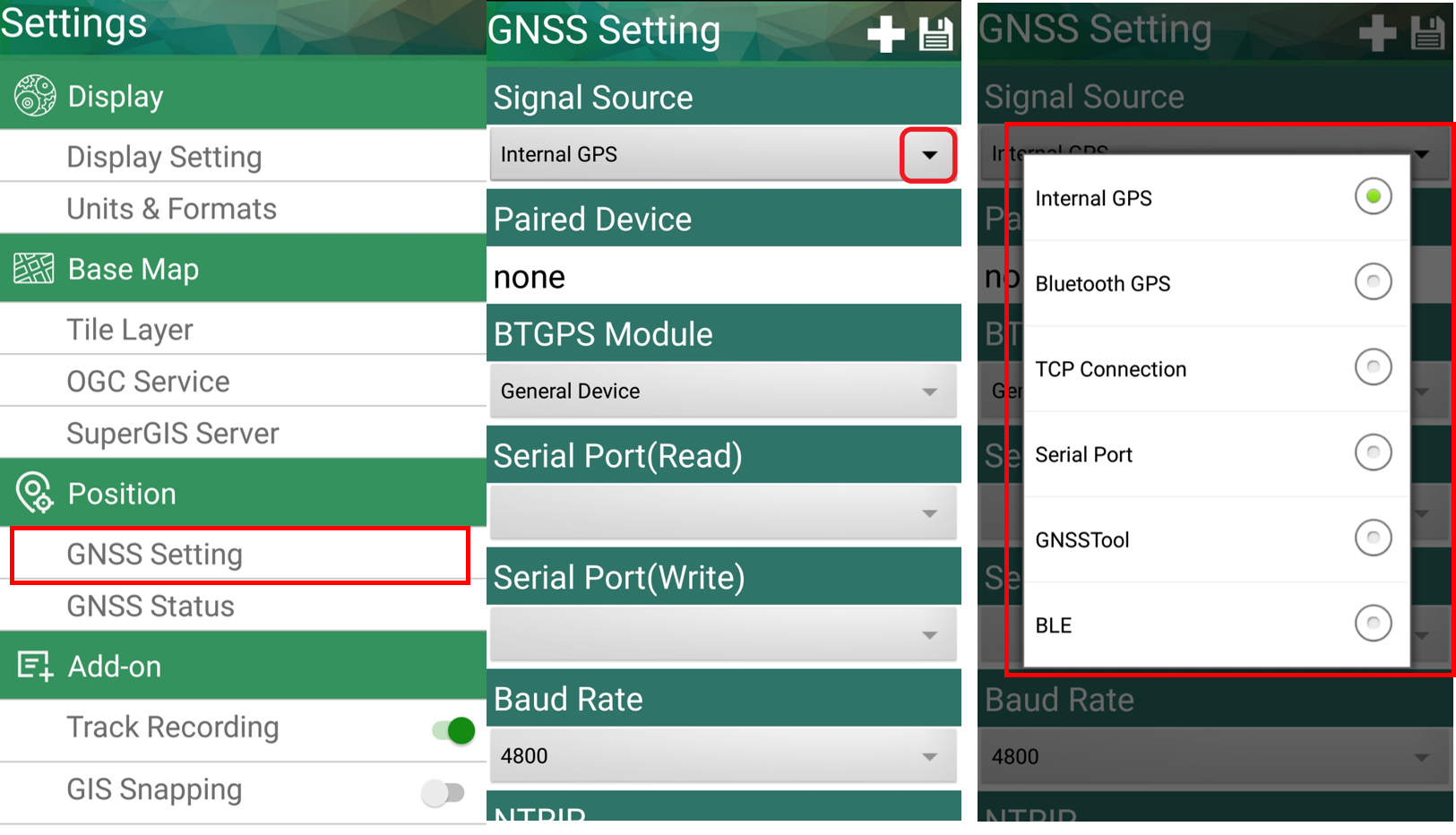
For using the external positioning sources, SuperSurv 10 allow user to connect to various of external GNSS receiver via Bluetooth communication. Please make sure the Bluetooth function had been turned on and already finish pairing with the external GNSS receiver. (Please notice: If you occur any trouble while pairing the Bluetooth external GNSS receiver with your Android device, we suggest you contact your hardware provider for further support.)
![]()
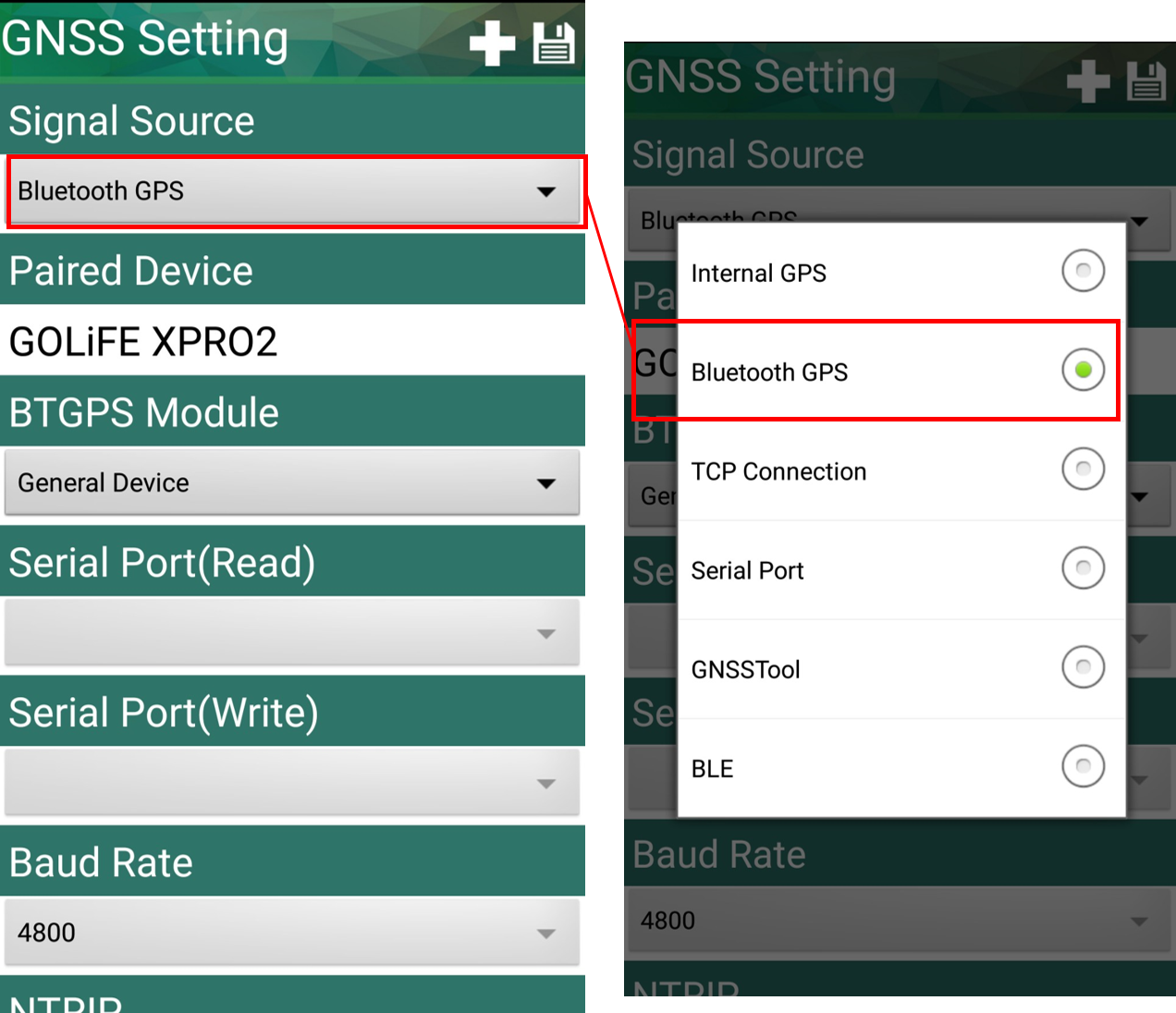
Next, please select the type of your external GNSS receiver. If the device you are using is the basic or consumer type of GNSS and will output the NMEA automatically, please select the General Device. If the device you are using is the mainstream profession high-accuracy GNSS receiver and is supported by SuperSurv, please select the corresponding option in the drop down list.

Now you can select the Bluetooth GPS in the Signal Source drop down list, and SuperSurv will start linking to the external Bluetooth GNSS receiver automatically. Start positioning and survey with your external Bluetooth GNSS device now!
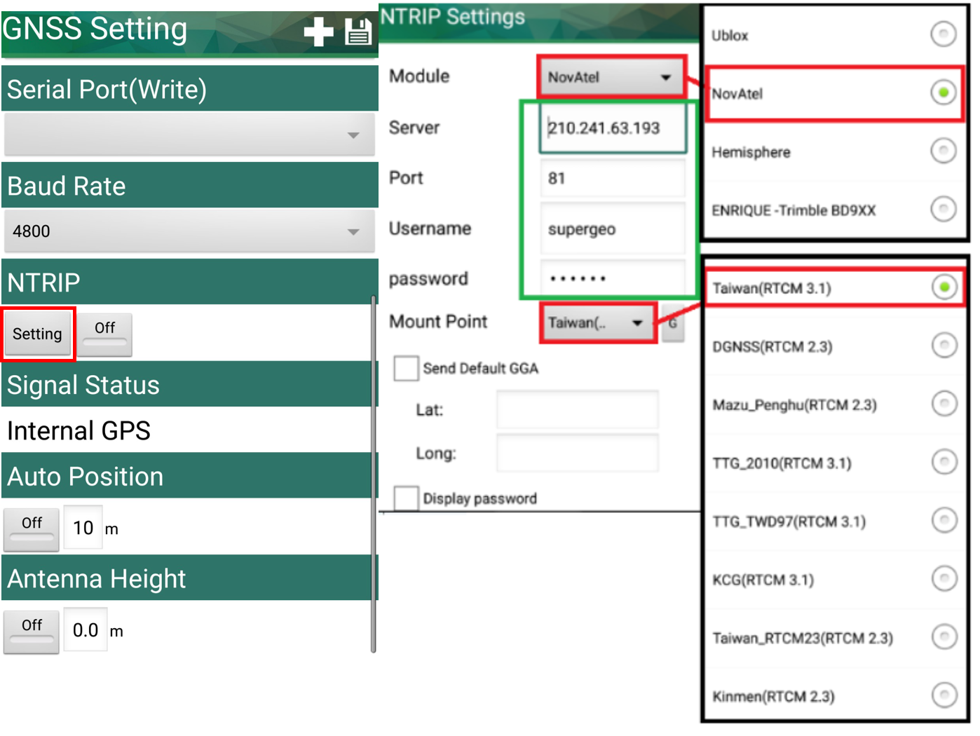
If your external Bluetooth GNSS receiver support NTRIP service and RTCM, you can simply setup the detailed settings and apply the linkage. Now SuperSurv 10 support about 80% GNSS module from 3 mainstream manufacturers: U-Blox, Hemisphere and NovAtel. After you enter the IP and Port of your NTRIP service caster, tab on the Get MountPoint button to receive the service list and select the option you want to apply with. After finishing setup, turn on the NTRIP service and SuperSurv will automatically receive the RTCM data and sent them to your external GNSS receiver via Bluetooth communication. If the RTCM data could be solved by the GNSS module, you will be having more accuracy positioning data for your field work.
© 2017 Supergeo Technologies Inc. All Rights Reserved.