
Whether to Use GPS
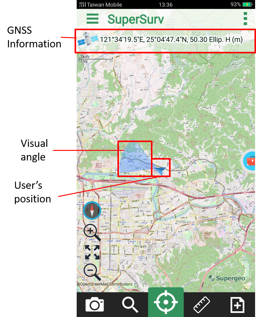
To display the current GPS position on the map, please tap ![]() to pan to the current GPS position. Then, a blue mark
to pan to the current GPS position. Then, a blue mark ![]() will be displayed on the map. The fan-shaped area is the visual angle. The longitude and latitude information will be displayed on the top of the map; tapping the information can convert to project coordinate system.
will be displayed on the map. The fan-shaped area is the visual angle. The longitude and latitude information will be displayed on the top of the map; tapping the information can convert to project coordinate system.
Note:
•After using GPS, you can use waypoint guidance and track record to help you have the guidance and track recording.
•If GPS is not used or no GPS signal is poor, waypoint guidance will be closed, track recording function will be stopped as well.
© 2017 Supergeo Technologies Inc. All Rights Reserved.