
Zoom Out
1.Tap the Explorer button on the main toolbar, switch to Explorer toolbar, tap the dropdown arrow of Zoom In > Zoom Out.
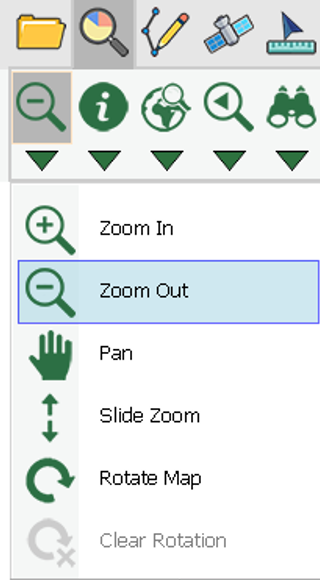
2.When the button displays the selected status, the function is activated. Then draw a rectangle on the map where you want to zoom out with stylus.
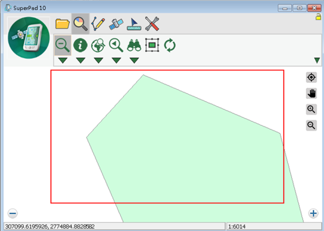
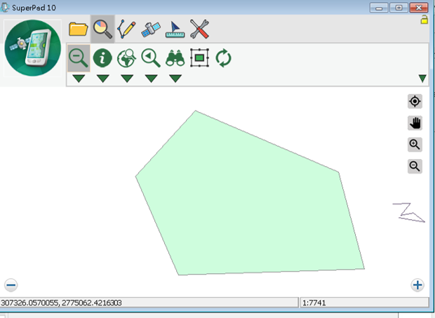
3.The drawn rectangle is zoomed out.
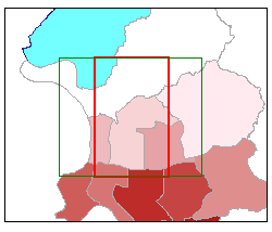
The way to zoom out map by drawing a rectangle gets involved with the map's ratio of width to height. It is of very little chance to have the drawn rectangle's ratio of width to height identical to that of map. Therefore, the system first takes the drawn rectangle's width or height as a standard and adjusts the other's ratio to meet the map's ratio of width to height. After the rectangle's ratio of width to height is adjusted identical to that of the map, the system will start to zoom out the adjusted new rectangle.
Please see the figures below. The square of thicker border is the rectangle drawn by user with stylus to zoom out while the square of thinner border is the adjusted square given by system (which is invisible on the map) that has ratio of width to height identical to the map. The figure in the left, the system takes the height of square of thicker border as the standard and automatically adjusts the width of square of thinner border to make the ratio of width to height identical to that of map. Then, the system will zoom in the square of thinner border in proportion. As a result, the square you want to zoom in will be zoomed in properly without ratio difference.
The function can be used repeatedly. If you want to stop Zoom Out function, please tap again Zoom Out button. When the selected status disappears, the function stops.
© 2017 Supergeo Technologies Inc. All Rights Reserved.