
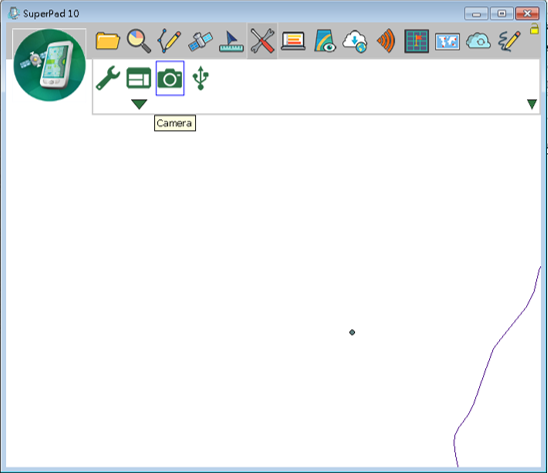
Camera
You can only use this function if the smart device is equipped with camera function. Activating this function can directly activate the camera function in smart device through SuperPad. With GPS positioning function, the coordinates of the place you take pictures can be saved to the picture file or can be used to generate photo layers. In the next, we are to take PDA as an example to explain the use.
Tap the System Settings button on the main toolbar, switch to System Settings toolbar, tap Camera and PDA will enter the camera mode.
After the picture is taken, “Input Coordinate” dialog box shows up. If GPS is activated, the system will input the coordinate values automatically or you can tap ![]() to input the current GPS position. Besides, in Angle, you can input the angle between you and the target, taking the north of the target as 0 degree to gain the angle; in Distance input the distance between you and the target. After that, you can use the four values of coordinate values, angle and distance between you and the target to estimate the coordinates of the target.
to input the current GPS position. Besides, in Angle, you can input the angle between you and the target, taking the north of the target as 0 degree to gain the angle; in Distance input the distance between you and the target. After that, you can use the four values of coordinate values, angle and distance between you and the target to estimate the coordinates of the target.
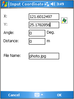
After the data is input, tap OK. The picture file will be stored in the folder you set in System Settings > Camera tab > Default Picture Folder.
© 2017 Supergeo Technologies Inc. All Rights Reserved.