
Steps to Generate Network Data
1.Before performing a network analysis, we need to convert the network data using the converter tool mentioned above. The network data includes road data (polyline vector files) and the location data (point vector files). When performing analysis, you can add locations at any time to confirm the precision of the orientation.
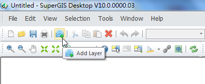
2. Click Add Layers on SuperGIS Desktop toolbar, and add the road layer you want to analyze to SuperGIS Desktop.
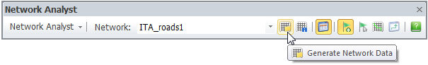
3. Click Generate Network Data. Only the converted network layer will be shown on the drop-down menu in the analyst. Loading a line layer without the corresponding network dataset (not being converted yet) enables “Options” and “Generate Network Data” functions only.
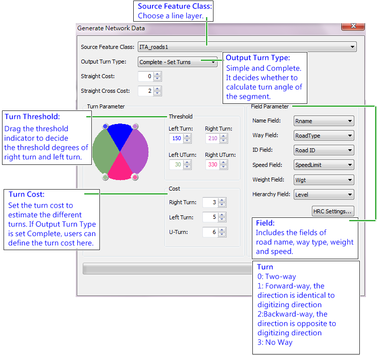
4. In Generate Network Data window, select the road data you want to analyze in “Source Feature Class” and set up the related settings. Click Start and the road data will be converted to network data for further network analysis. To learn more about each parameter in Network Data window, please check parameters of Generate Network Data chapter.
5. If the road data has no spatial reference, a dialog box will pop up and ask you whether to use degree or meter. Clicking “Yes” means to use degree (longitude and latitude) as map unit; clicking “No” means to use meter as the map unit.
6. When the conversion is finished, start Network Analyst in SuperGIS and load the network layer. Please make sure that the corresponding data (five types of files including *.nnd, *.nrt, *.ntn, *.nvt and *.wgt) of the line layer is stored in the same folder of the line layer.
7. After the network data is successfully loaded, according to your purpose and choose a solver to start to perform the Network analysis.
©2016 Supergeo Technologies Inc. All rights reserved.