
Establishment of Co-Kriging Estimation
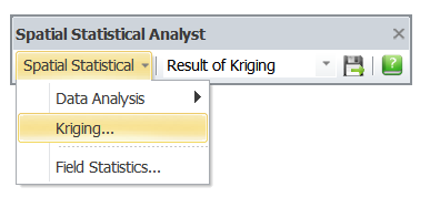
1.Select Kriging on the Spatial Statistical Analyst toolbar.
2.Add two or more datasets and set up the respective data fields, including “the fields to be analyzed” and “X-Y axes.”
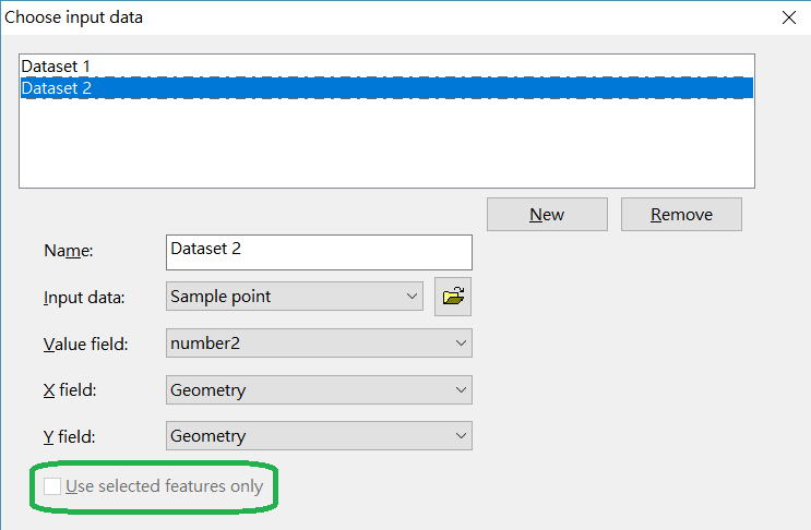
If you already selected some features on the map, you can check “Use selected features only” so you can analyze with the selected features on the map only. If no feature is selected o the map, this item will be disabled.
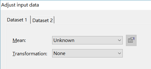
3.Process and set up each dataset.
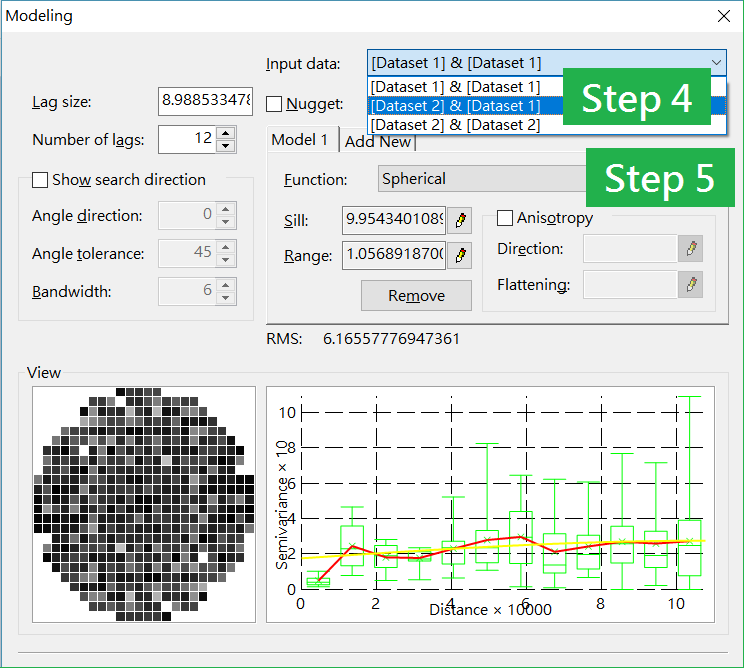
4.Select 2 different dataset in Input Data to start analysis.
5.Set up the parameters and select a fitting mode. Click Next and the semivariance model is finished.
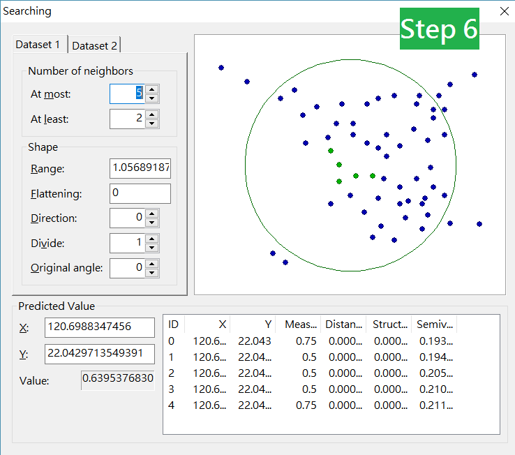
6.Set up the extent of Search, and click Next.
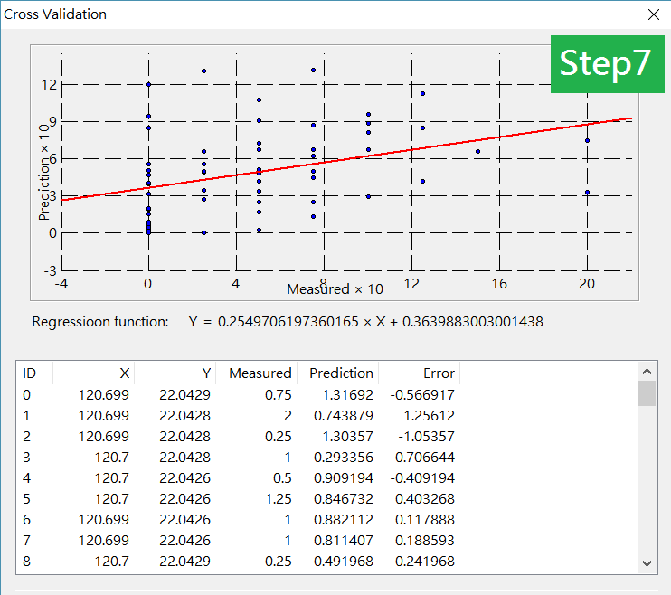
7.Cross-Validation Dialog box shows up and you can view the distribution of your estimation. Click Finish to finish the Co-Kriging estimation.
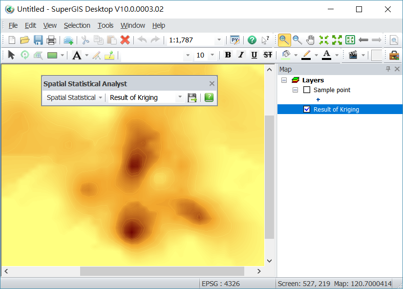
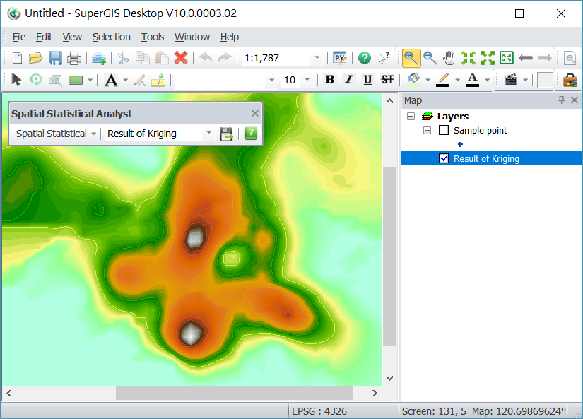
8.The result layer of “Result of Kringin” is added to the Layers and displays on the map. You can move the source layer to the top so you can easily compare the two.
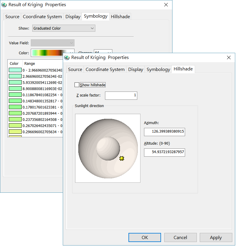
9.Right-click on “Result of Kringing” layer and click “Properties” on the pop-up menu.
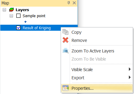
10.In Properties window, you can set up as your need, such as title, coordinate system, display, symbology and hillshade.
11.The map displays based on your settings.
©2017 Supergeo Technologies Inc. All rights reserved.