
Straight Line Distance
Straight line distance measures the straight line distance from each cell to its closest source (school, hospital, first-aid station, etc.) With the analysis, we can understand the distance from each cell location to its closest source; besides, through Euclidean direction tool, we can realize the direction of each cell location to its closest source or get which is the closest source.
The Euclidean distance algorithm is employed in the analysis, it calculates and get the Euclidean distance from the center of each source to the center of each cell according to the concept of finding the hypotenuse based on the other two given legs of the triangle.
Straight Line Distance
It finds the straight line distance from each cell to its nearest source, the distance unit is based on the projection unit of the output raster; the measurement is calculated from the source to the center of each cell. So the output cell represents: the distance to the nearest source.
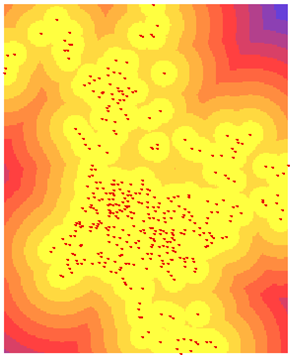
The analysis helps to find out some answers, like the distance to the nearest hospital, how far away can we arrive the rest area?
Allocation
Allocation analysis finds and assigns the value of the nearest source to each cell; in other words, the output raster cell represents the nearest source to the cell.
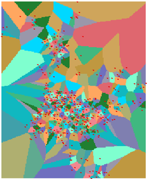
This analysis helps to find out for instance, which hospital is the nearest? Which rest area is the nearest?
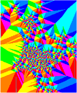
Direction
With the source's location as center, partition the space direction into different areas based on Euclidean distance rule. To different area, the bearing of each cell to its nearest source obtained based on the Euclidean distance rule will be assigned to each cell. The calculation unit is degree; the north is 360 degrees. That is, the output cell value represents the direction from cell to its nearest source.
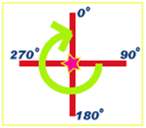
The analysis helps to find out what is the direction of the nearest hospital? What is the direction of the nearest rest area?
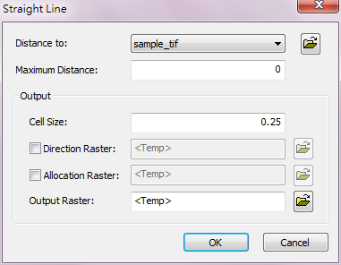
Description of Parameters
Item |
Description |
Data Type |
Distance to |
The raster data to be calculated distance. |
Raster layer |
Maximum Distance |
To define the maximum distance, if the value exceeds this value, it will be assigned NoData. The default is the maximum distance of the input raster.(The distance can be measured using map tools in SuperGIS). |
Raster layer/constant |
Cell Size |
The size of the output cell. |
integer/floating point |
Direction Raster |
The direction output raster. Set the filename and storage path for the output raster. |
Raster layer |
Allocation Raster |
The allocation output raster. Set the filename and storage path for the output raster. |
Raster layer |
Output Raster |
The filename and storage path of the output raster. |
Raster layer |
©2016 Supergeo Technologies Inc. All rights reserved.