
Sink
Sink is the area with unreasonable flow direction due to the real surface condition, insufficient resolution of elevation or error in modeling surface runoff. The phenomenon often causes the water sediment, resulting in wrong evaluation on runoff. Sink Analyst identifies the sinks with the flow direction.
Description of Parameters
Item |
Description |
Data Type |
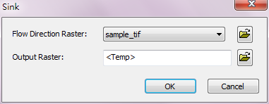
Flow Direction Raster |
The input flow direction raster to be performed Sink analysis. |
Raster data |
Output Raster |
The filename and storage path of output raster. |
Raster data |
©2016 Supergeo Technologies Inc. All rights reserved.