
Shrink
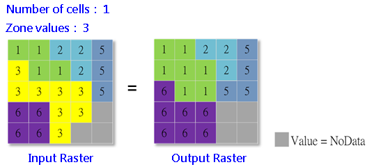
Shrink tool is contrary to Expand. It shrinks the zone of a specified value. The cells whose value is identical to the zone values we set in Shrink dialog will be the center. Then, the system starts to find the value (NoData is accepted) that is most frequent in its neighbor by eight directions. The most frequent value then will replace the original cell value. After that, shrink the zone. If the number of cells to shrink is greater than 1, the number of calculations will be identical to the number of cells to shrink. For instance, if we set to shrink by 2 cells, the system will shrink by one cell in the input raster first; then,continues to shrink the second time on the result raster.
Description of Parameters
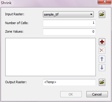
Item |
Description |
Data Type |
Input Raster |
The raster data to be shrunk. |
Raster data |
Number of Cells |
The number of cells to shrink. |
Integer |
Zone Value |
The cell values to shrink. |
Integer/Floating point |
Output Raster |
The filename and path of the output raster. |
Raster data |
©2016 Supergeo Technologies Inc. All rights reserved.