
Shortest Path
The shortest path, the expansion of cost weighted distance analysis, calculates the least cost path from a start point to destination. The analysis will outputs a layer that records the least cost path raster from a specific area to the closest source cell. The so-called start raster is defined based on cost weighted distance on the accumulative cost surface.
Conceptually, the width of shortest path is a cell, the distance between the target and source. The unit is the same as the coordinate of the input cost raster. Before performing shortest path analysis, we need to get the cost weighted distance raster and back link raster through cost weighted distance analysis. If a cell is defined NoData, it will not be contained in the calculation. But the cell value of 0 for input raster or for output raster are both considered as a reasonable cell and will be contained in calculation.
Shortest analysis can be used to find out the shortest shopping mall (destination) from different suburban location(start point).
Description of Parameters
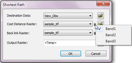
Item |
Descripiton |
Data Type |
Distance to |
The raster data to be performed distance analysis. |
Raster layer |
Cost Raster |
The cost raster for shortest path analysis. Users can click the |
Raster layer |
Back link Raster |
Output the back link raster and set filename and storage path. Users can click the |
Raster layer |
Output Raster |
The filename and storage path of the output raster. |
Raster layer |
©2016 Supergeo Technologies Inc. All rights reserved.