
Flow Length
Flow Length is the horizontal projection length of the greatest surface distance from a point on the surface to the beginning(or end) of the stream along the flow direction. Flow length is a crucial factor for soil conservation; if the flow length is long, the flow volume will be huge and the erosion will be stronger. Downstream or Upstream measurement is provided for option; Downstream calculates the distance from the cell to the pour point along the steam(horizontal projection distance); Upstream calculates the distance from the cell to the top of the ridge along the stream(horizontal projection distance).
Description of Parameters
Item |
Description |
Data Type |
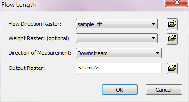
Flow Direction Raster |
The flow direction raster to be performed Flow Length analysis. |
Raster data |
Weight Raster |
Restrict the length of output flow by setting weight, the default is 1. |
Raster data |
Direction of Measurement |
Switch to different measurement type. |
Analysis option |
Output Raster |
The filename and storage path of output raster. |
Raster data |
©2016 Supergeo Technologies Inc. All rights reserved.