
Flow Accumulation
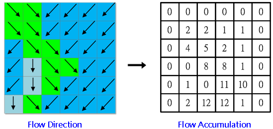
In the process of simulating runoffs, the flow accumulation is created by calculating the flow direction. To each cell, the flow accumulation is determined by how many cells that flows through that cell; if the flow accumulation value is greater, the area will be easier to form a runoff. The system will calculate the rasters with the weight of 1 by default, if it is not set.
If a cell has larger value, it means the cell is in an area where the flows are much focused, and it will be identified as the valley. 0 indicates that the location of the cell is at higher elevation, and it will be identified as the ridges.
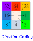
The process from calculating flow direction to flow accumulation is like figures as below:
Description of Parameters
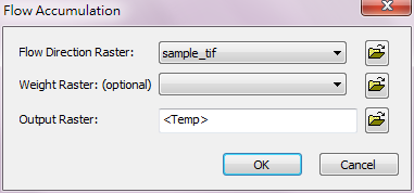
Item |
Description |
Data Type |
Input Direction Raster |
The direction raster to be performed Flow Accumulation . |
Raster data |
Input Weight Raster |
Limit the output flow by giving weight, the default is 1. |
Raster data |
Output Raster |
The filename and storage path of output raster. |
Raster data |
©2016 Supergeo Technologies Inc. All rights reserved.