
Exercise 3 - Evaluate the pollution rate with Spatial Analyst
Generally speaking, pollution can be divided into air pollution, water pollution, solid waste pollution, soil pollution and radioactive pollution. Now the pollution range expands even larger, the emerging pollution like ship pollution, light pollution, noise pollution, heat pollution and over-consuming are started to get attention. Taiwan is a kingdom of industry, and in this exercise we will find out the pollution rate for each cell in some of the industrial districts in New Taipei city with interpolation tool.
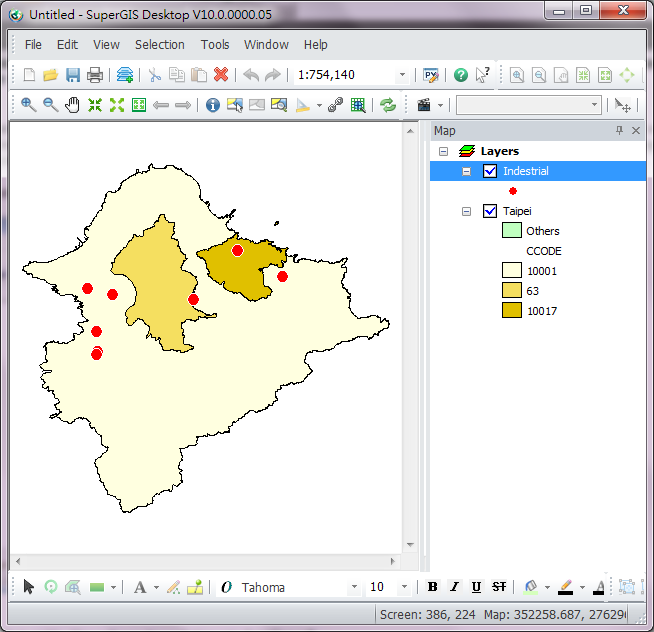
1.Load New Taipei city layer(Taipei.shp) and industrial district layer(Indestrial).
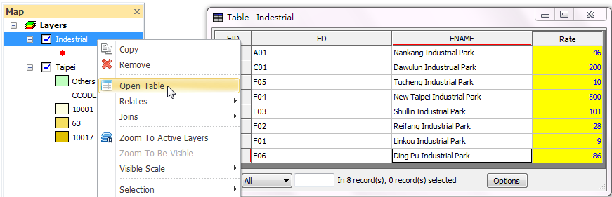
2.Right-click the Industrial layer and open the attribute table. You will see the pollution rate field(Rate).
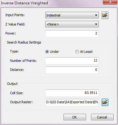
3.Select "Spatial Analyst">"Interpolation">"Inverse Distance Weighted."
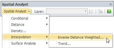
4.Inverse Distance Weighted window shows up and follow the steps as below:
i.Select the industrial layer(Industrial) in Input Points.
ii.Select the pollution rate field(Rate) in Z value field.
iii.You can change the sell size, but in this exercise, we will keep the setting.
iv.Select the output path and enter the filename.
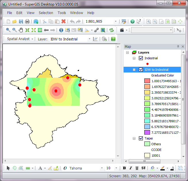
5.The figure below shows the result of pollution rate of industrial districts in New Taipei city. We can learn from it that the pollution rate in industrial district is comparative higher, while the other parts which are interpolated are progressively decreasing.
©2016 Supergeo Technologies Inc. All rights reserved.