
Corridor
Corridor analysis combines two cost weighted distance results and reclassifies them. So the combined cost area whose cost is under some standard can be queried; the area is so called "Corridor." For each cell, the sum of the cost distance (accumulative costs), the two input accumulative cost rasters can be calculated. The sum of the two raster costs can be used to identify the least cost path from one source to the cell location and to another source.
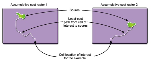
To perform corridor analysis, two accumulative cost rasters are needed to be created with "cost weighted distance analysis", please see the figure below.
The two accumulative cost rasters are added together to become one corridor analysis result raster, please see the figure below.
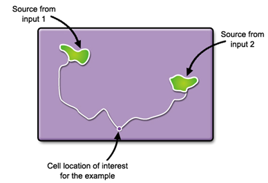
The output raster does not only identify the least cost path between the two sources but also identify the range of accumulative costs between the two sources. In other words, the least accumulative cost to arrive source 1 plus the least cost accumulative cost to arrive source 2 equal to the sum of the accumulative cost. The sum of the accumulative cost is the least accumulative cost if a path is routed from source 1 to source 2 passing by the cell.
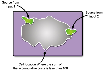
If the cells which have the value less than the maximum accumulative distance (or threshold) are chosen from the corridor raster, the output raster will form a swath cell, that is corridor, but not a single line (the least cost path).
The corridor analysis is applied to landscape, ecology, etc. For instance, in a conservation plan, you can connect two patches of deer habitat with the corridor tool to find an optimal corridor instead of simply buffering a single path. Or in an urban plan, corridor tool can be used to connect the green lands in the city as the ecological corridor, retaining the biodiversity in city and further helps improve the urban ecology benefits.
Description of Parameters
Item |
Description |
Data Type |
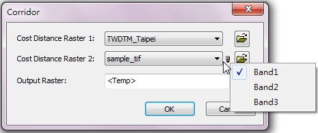
Cost Distance Raster 1 |
The cost distance raster to be performed corridor analysis (it must be created using cost weighted distance analysis). |
Raster layer |
Cost Distance Raster 2 |
The cost distance raster to be performed corridor analysis (it must be created using cost weighted distance analysis). Users can click the |
Raster layer |
Output Raster |
The filename and storage path of the output raster. |
Raster layer |
©2016 Supergeo Technologies Inc. All rights reserved.