
Calculation with Raster
It allows users to do analysis to implement the multiple tasks. This tool does statistics to different rasters, so you can do the logical operation of mathematical formula to transfer the source imagery raster to another imagery raster. It helps users analyze the spatial imagery information more completely. If there are any pixel value represented as NoData, then the it will be exported as NoData as well.
Mathematical Operation of Imagery Raster
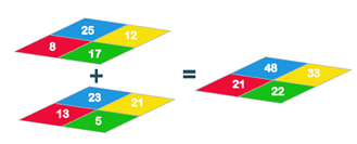
Users can calculate multiple rasters in SuperGIS Spatial Analyst 3. It allows users to mathematically calculate the cells from more than two rasters or one single raster and generate another raster.
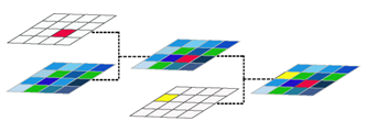
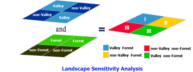
Logical Operation of Imagery Raster
The logical expression of imagery raster allows users to filter and operate across multiple imagery rasters and get the result imagery raster.
Parameters of Raster Calculator
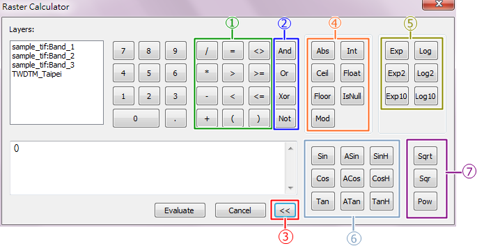
1."+, -, *, /", the four arithmetic operations, they respectively represent add, subtract, multiply and divide. "<, >, =, (, ), <>, >=, <=" calculates the relationships between specified rasters.
2.![]() "And, Or, Xor, Not" are logical operators; the result should be "1"(True) or "0" (False).
"And, Or, Xor, Not" are logical operators; the result should be "1"(True) or "0" (False).
"And", assuming the value of A and the value of B can be 0 or 1 only, the result of A AND B can be 1 only when both of them are 1.
"Or", assuming the value of A and the value of B can be 0 or 1 only, the result of A OR B can be 1 only when one of them is 1.
"Xor", assuming the value of A and the value of B can be 0 or 1 only, the result of A XOR B can be 1 only when they are not equal to each other.
"Not", assuming the value of A and the value of B can be 0 or 1 only, the result of NOT will simply change value of 0 to 1 or change value of 1 to 0.
|
3.">>" opens the advanced logical operators.
4."Abs, Ceil, Floor, Mod, Int, Float, IsNull" are the keys of arithmetical functions.
5."Exp, Exp2, Exp10, Log, Log2, Log10" are keys of logarithmic functions.
6."Sin, Cos, Tan, ASin, ACos, ATan, SinH, CosH, TanH" are keys of trigonometric functions.
7."Sqrt, Sqr, Pow" are keys of power functions.
©2016 Supergeo Technologies Inc. All rights reserved.