
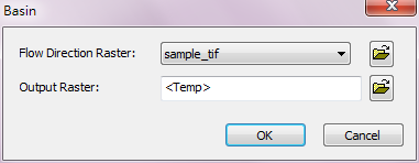
Basin
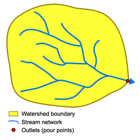
The basin means a watershed separated apart from different water systems by and inside ridge lines. In the analyst, by analyzing the input flow direction raster we can find the connected cells that belong to the same drainage basin. When separating the basins, assumed the outlets are located at the edge of the analysis extent, after the locations of the outlets are confirmed, the watershed area that flows into will be set as the basin.
Description of Parameters
Item |
Description |
Data Type |
Flow Direction Raster |
The flow direction raster to perform Basin analysis. |
Raster data |
Output Raster |
The filename and storage path of output raster. |
Raster data |
©2016 Supergeo Technologies Inc. All rights reserved.