
Aggregate
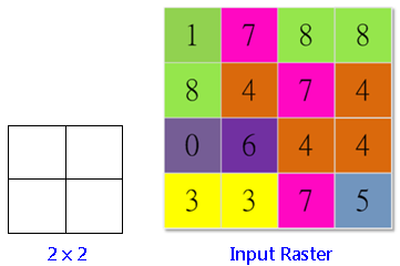
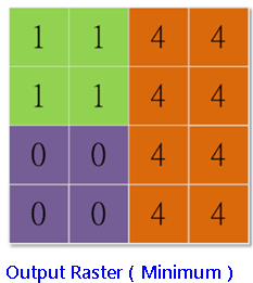
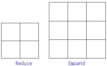
In the Aggregate dialog, a new raster will be generated based on the setting of "Cell factor" and "Aggregate Method" (sum, maximum, minimum, mean or median). For instance, if we set "cell factor" as 2, the input raster will be considered as the standard, and each 2x2 input cells will be drawn as an output raster and so on till the entire output raster is finished. But sometimes, the extent of the output raster is larger than the original raster, at the time, users can expand or reduce the output raster by using "Expand" or "Reduce." If users check "Expand" (the default), the system will expand the bottom or the right boundary of the output raster and the expanded cells will be assigned NoData. If users check "Reduce", the extra cells will be removed. After the cell size of the output raster is determined, the output cell value will be decided based on the aggregate method users select.
See the figure below for brief description.
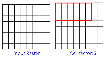
The "Cell factor" sets 3: The raster in the figure of lower left side will be taken as the basis and generate a new raster with a 3x3 cells size.
The respective output result for "Reduce" and "Expand" of same input.
Description of Parameters
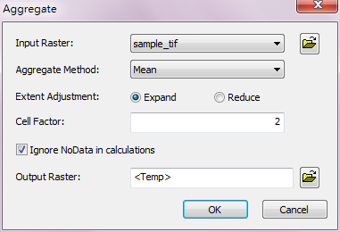
Item |
Description |
Data Type |
Input Raster |
The raster data to aggregate. |
Raster layer |
Aggregate Method |
The aggregated method to calculate: •Minimum:calculate and get the smallest value. •Maximum: calculate and get the largest value. •Range: calculate and get the difference of the largest and smallest values. •Sum: calculate and get the sum. •Mean: calculate and get the average value. •Standard Deviation: calculate and get the standard deviation. •Variety: calculate and get the variety. •Majority: calculate and get the majority. •Minority: calculate and get the minority. •Median: calculate and get the median. |
Analysis option |
Extent Adjustment |
Define the treatment when the size of the input raster is over-sized or insufficient for analysis: •Expand •Reduce |
Analysis option |
Cell Factor |
The cell factor for analysis. |
Integer |
Ignore NoData in Calculations |
Whether to ignore the cells that are NoData in neighborhood. |
Analysis option |
Output Raster |
The filename and path of the output raster. |
Raster layer |
©2016 Supergeo Technologies Inc. All rights reserved.