
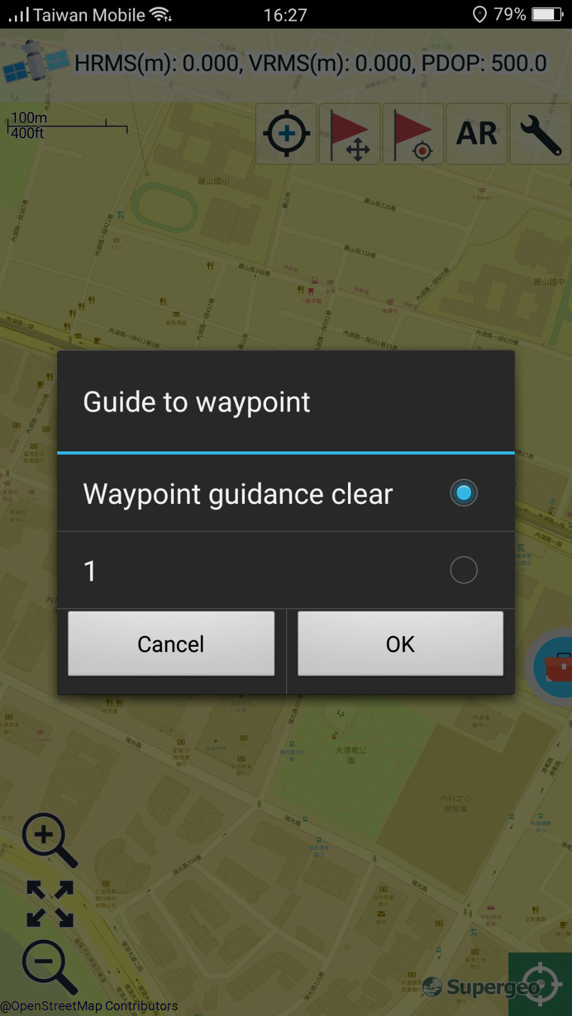
Waypoint Guidance
As GPS is used, you can select a waypoint as the destination of the waypoint guide. The system will calculate the shortest straight line distance between the current GPS position and waypoint; an orange dashed line will be connected between the two points on the map. Also, the information of waypoint guidance will appear on the top of the map and guide the users to the destination.
1. Tap ![]() you would like to see the guidance.
you would like to see the guidance.
2. Select the waypoint you need from Guide to Waypoint page. If you would like to clear waypoint guidance, select ??Waypoint guidance clear?? and the guidance will be cleared.
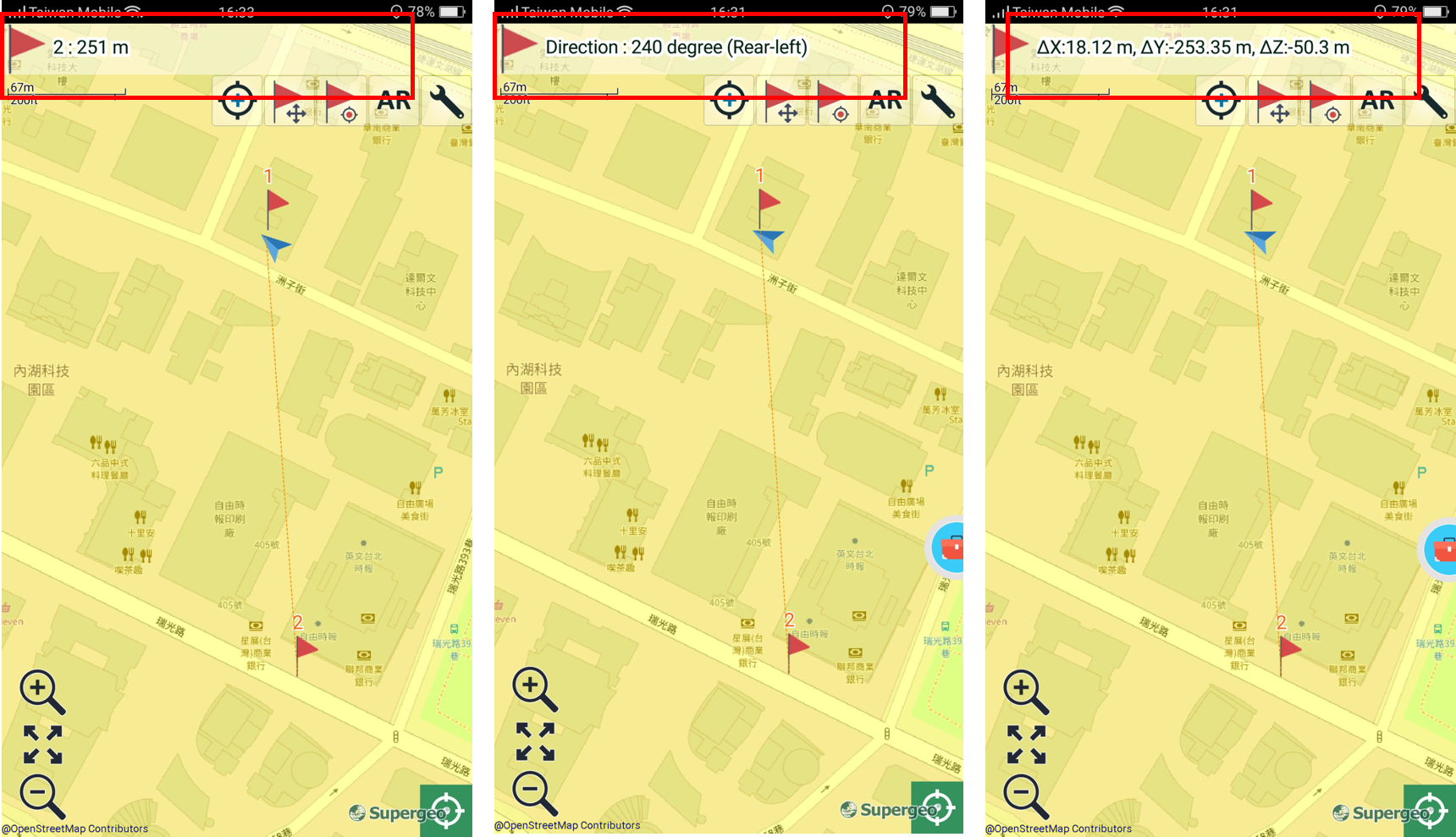
Guidance information includes:
(1) Waypoint name
(2) Switch to the shortest straight line distance between current GPS position and waypoint destination
(3) Switch to waypoint guidance
© 2017 Supergeo Technologies Inc. All Rights Reserved.