
Measure Tools
In field survey, if you would like to know the real length or area on the map, you can measure with the tools. Besides, the system also provides the function to measure features. Please refer to the description to operate:
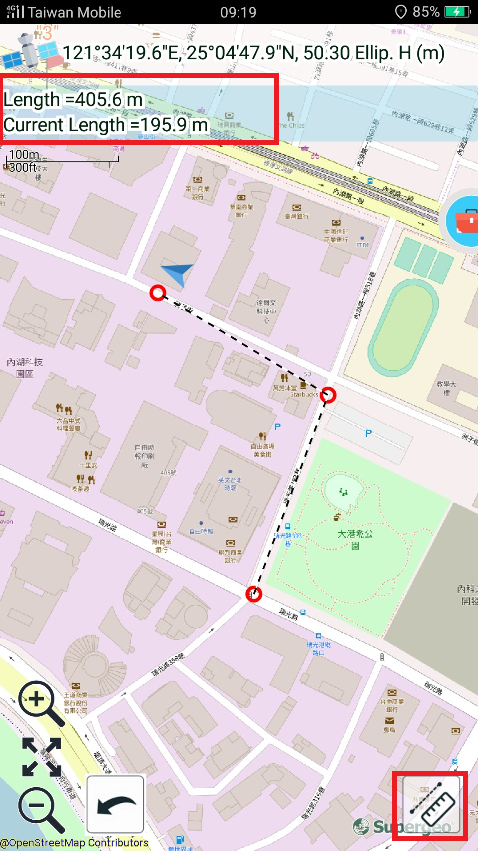
Line Measurement |
Area Measurement |
Feature Measurement |
Undo |
|
|
|
|
1. Tap Measure ![]() , and the measurement toolbar will show up.
, and the measurement toolbar will show up.
2. Tap length measure ![]() or area measure
or area measure ![]() .
.
3. Tap Undo ![]() , you can cancel the current measurement.
, you can cancel the current measurement.
4. The system will calculate the total length or area of the segment or extent and display the results on the map.
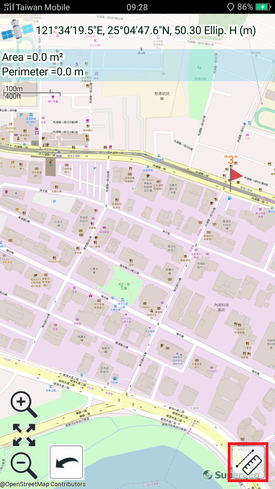
5.Tap “Measure Feature ![]() " and tap on point, polyline or polygon feature on the map to respectively get the XY coordinates, length, perimeter and area. Users can also measure SuperGIS Server layer features.
" and tap on point, polyline or polygon feature on the map to respectively get the XY coordinates, length, perimeter and area. Users can also measure SuperGIS Server layer features.
![]()
6. Tap back button of mobile device, you can close the measurement mode.
Note:
•Line measurement units include: meter and kilometer (the line longer than 1000 m will be displayed with km); area measurement units include: square meter, hectare(the area larger than 10000 square meters will be displayed with square hectare), and square kilometer (the area larger than 1000 hectare will be displayed with square kilometer)
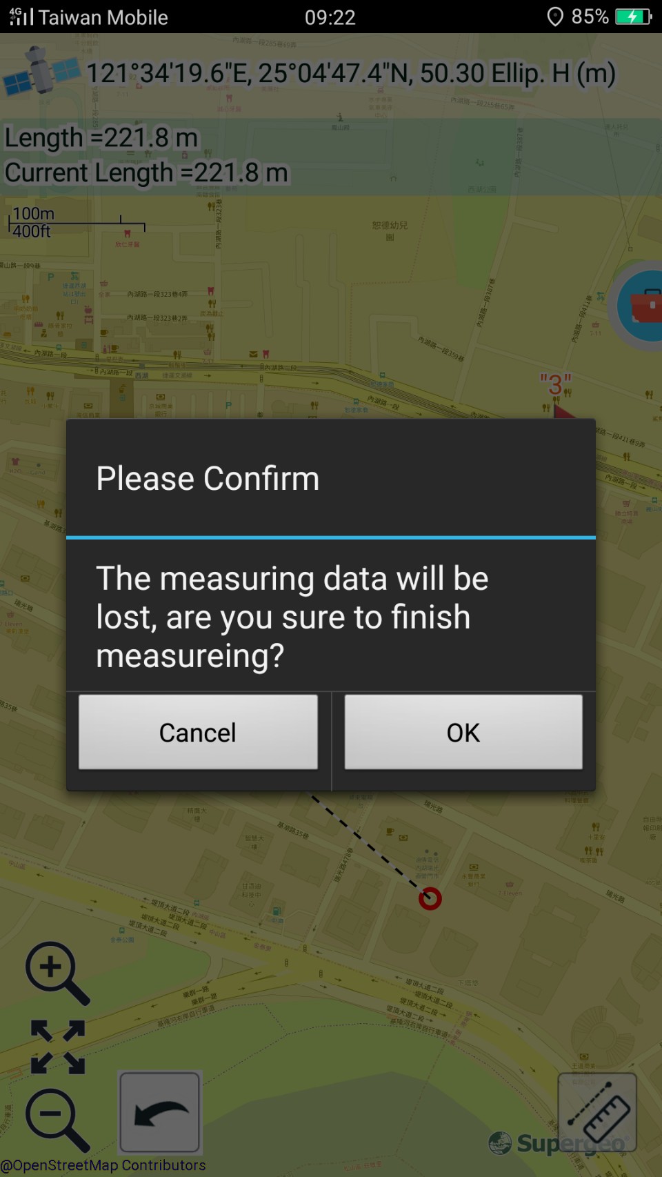
•The message below will show up if you are measuring but switch to different measurement or tap finish measurement. Tap OK and the current measurement will be canceled.
© 2017 Supergeo Technologies Inc. All Rights Reserved.