
Exporting Waypoints
Surveying with SuperSurv in the field, you can work with waypoint, and the waypoint can be used as an annotation of position (please refer to Adding Waypoints). After surveying, you can export the waypoints to export the points to check and display them on different platforms.
1. In SuperSurv, tap menu > Add Waypoint. > Tap settings button ![]() on waypoint toolbar.
on waypoint toolbar.

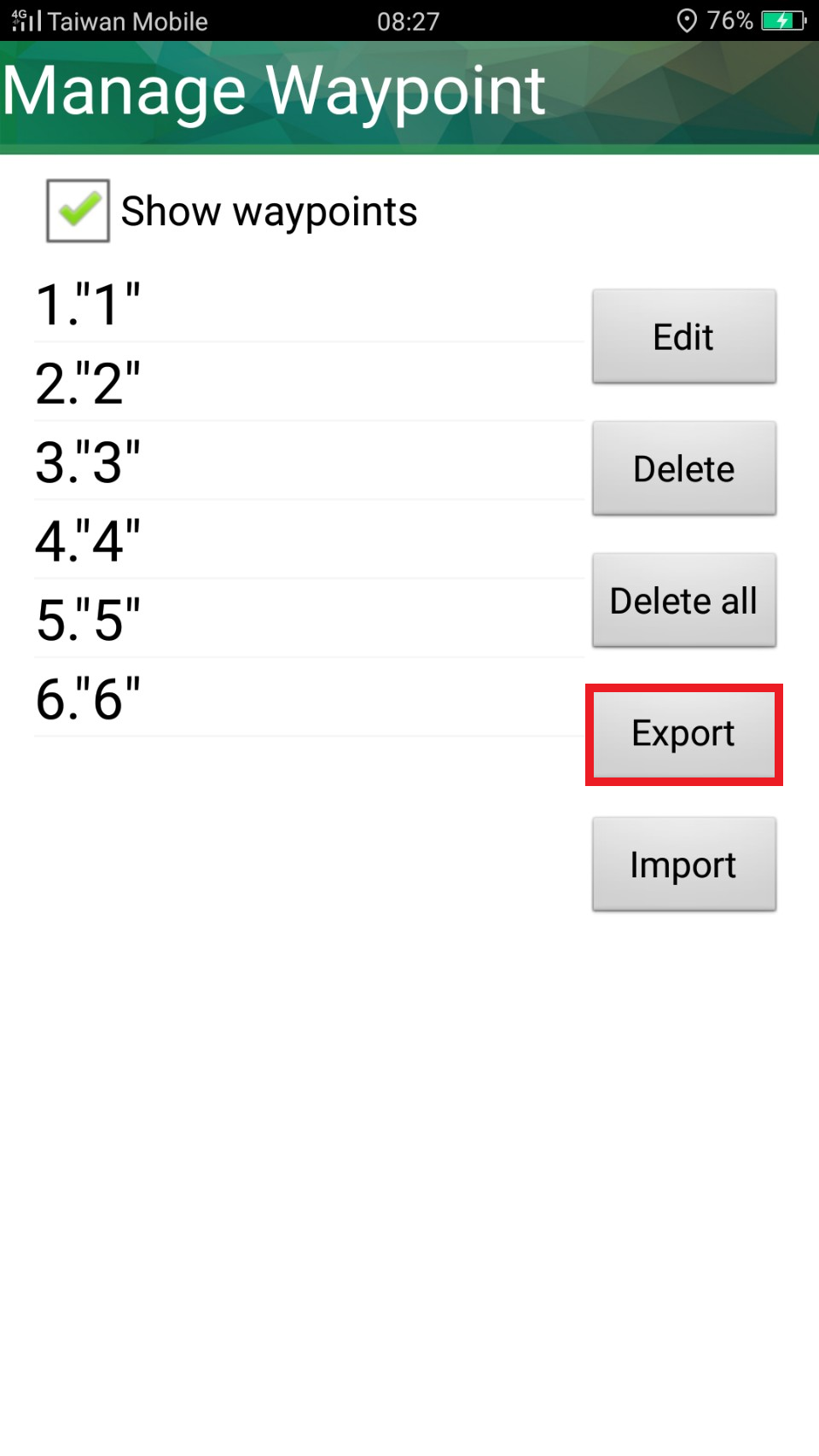
2. In Waypoint management window, the waypoints will be listed on the left, and Export is on the right. You can export all the waypoints as files.
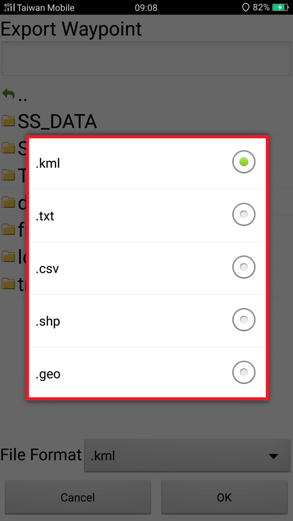
3.Enter the file name and choose the file format to export. There are 3 formats, KML, TXT, CSV. After setting, please tap OK.
The waypoint is exported successfully. The message will show up and display the path.


Note:
Waypoints can be exported and saved as TXT, CSV, KML formats. You can upload the data to PC, other applications, or on Google Earth.
© 2017 Supergeo Technologies Inc. All Rights Reserved.