
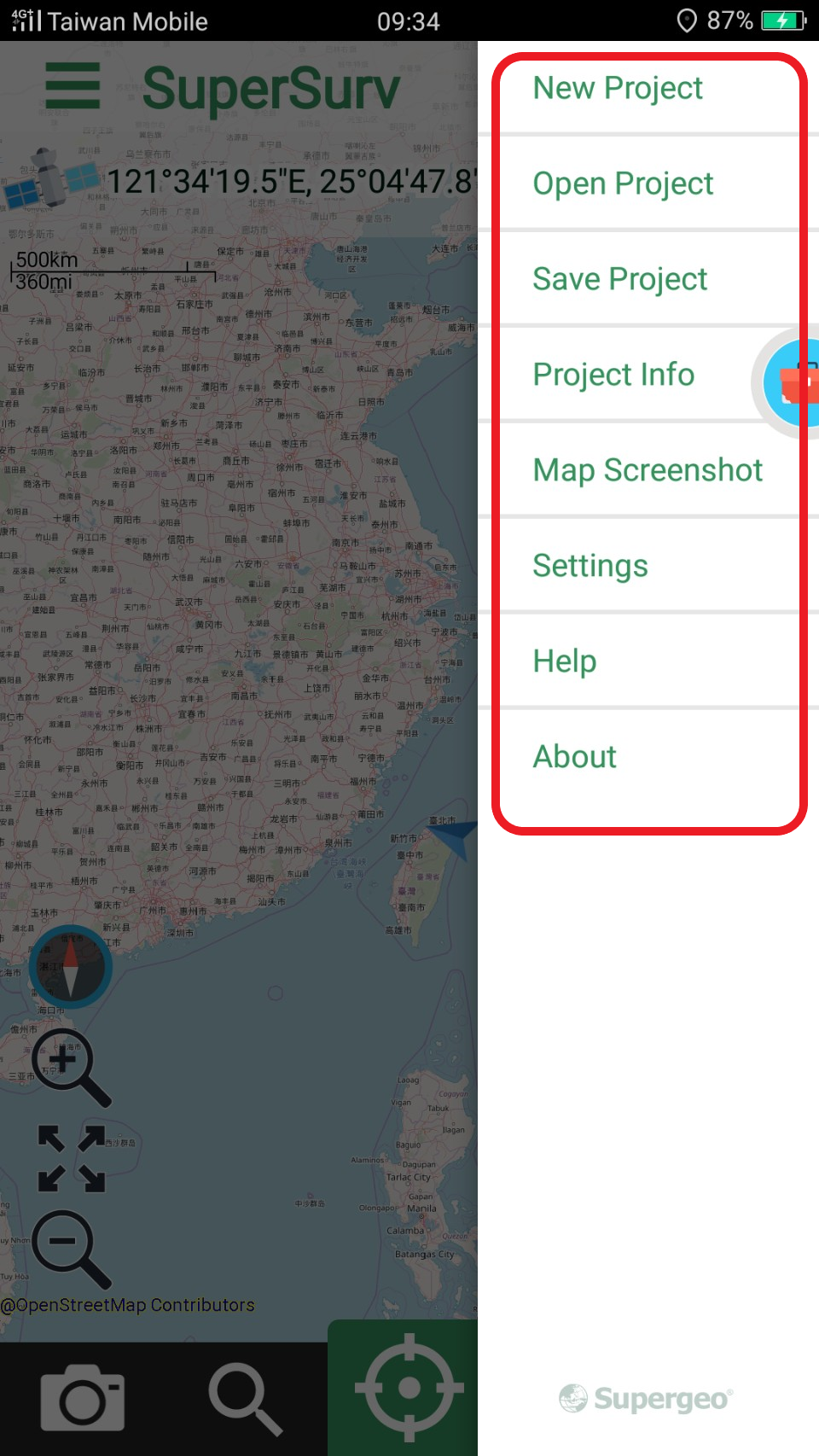
Major System Interface
The major system interface includes “map display”, “map toolbar”, “upper function list” and “lower function list.”
![]()
Map Display |
The loaded files will be displayed here. |
|---|---|
Map Toolbar |
The toolbar at lower left corner is the map toolbar. You can Zoom in and out, or zoom to full extent with tab the icon. |
Upper Function List |
The function list at top of the major interface includes "GPS Orientation" and "Menu." |
Lower Function List |
The function list at bottom of the major interface includes "Measure", "Query", "Survey' and "Layer Management." |
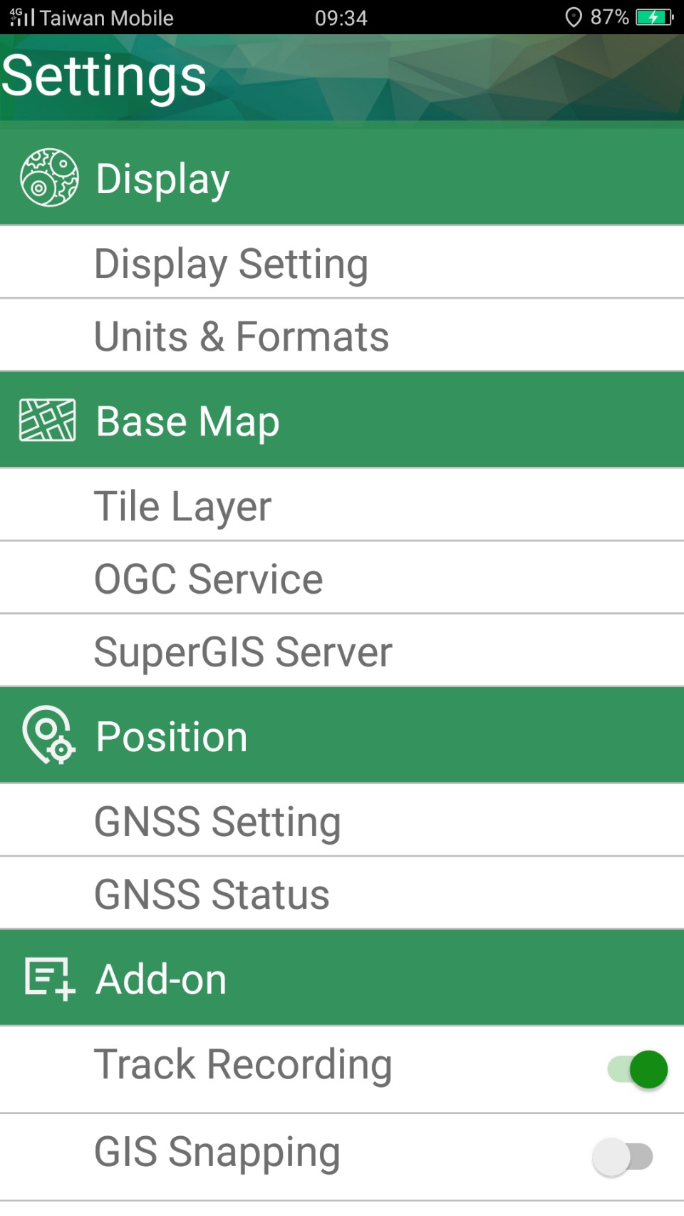
Tapping “Menu” button of the mobile device will open a menu which allows you to open/save project, create project, enter “Settings/View” and “About.”
In Settings/View page, you can use Map element and tap settings, Set base map, GPS Setting, Dimension setting (Measure Function), View Location information, View project information, Plugin Settings, Set SuperGIS Server. As to the details of how to set these items please refer to settings/view.
”About” shows the copyright and the software version. You can exit by tapping “Close.”
![]()
© 2017 Supergeo Technologies Inc. All Rights Reserved.