
Adding Waypoints
In field survey, you might need to add some points to survey temporarily because of accidents or missions. Then, you can create new waypoints to complete the operation. Or when you are surveying, you might need to add some point information (e.g. building, tree, etc.) for references, you also can apply waypoints to achieve the target.
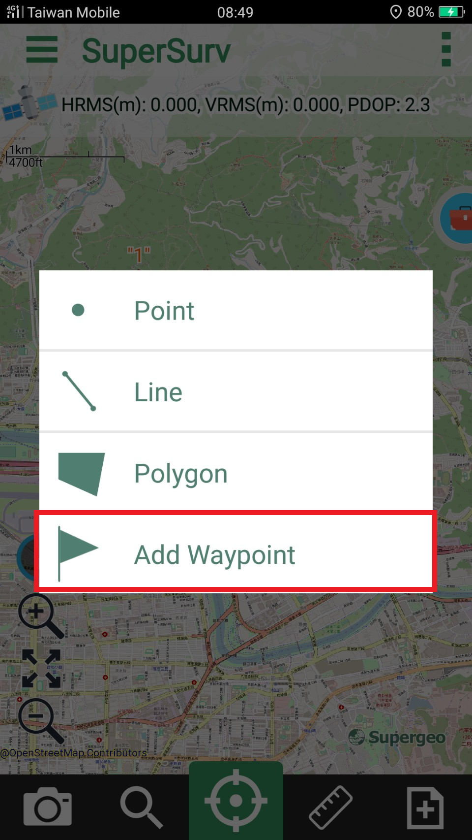
1. Press ![]() > Add Waypoint.
> Add Waypoint.
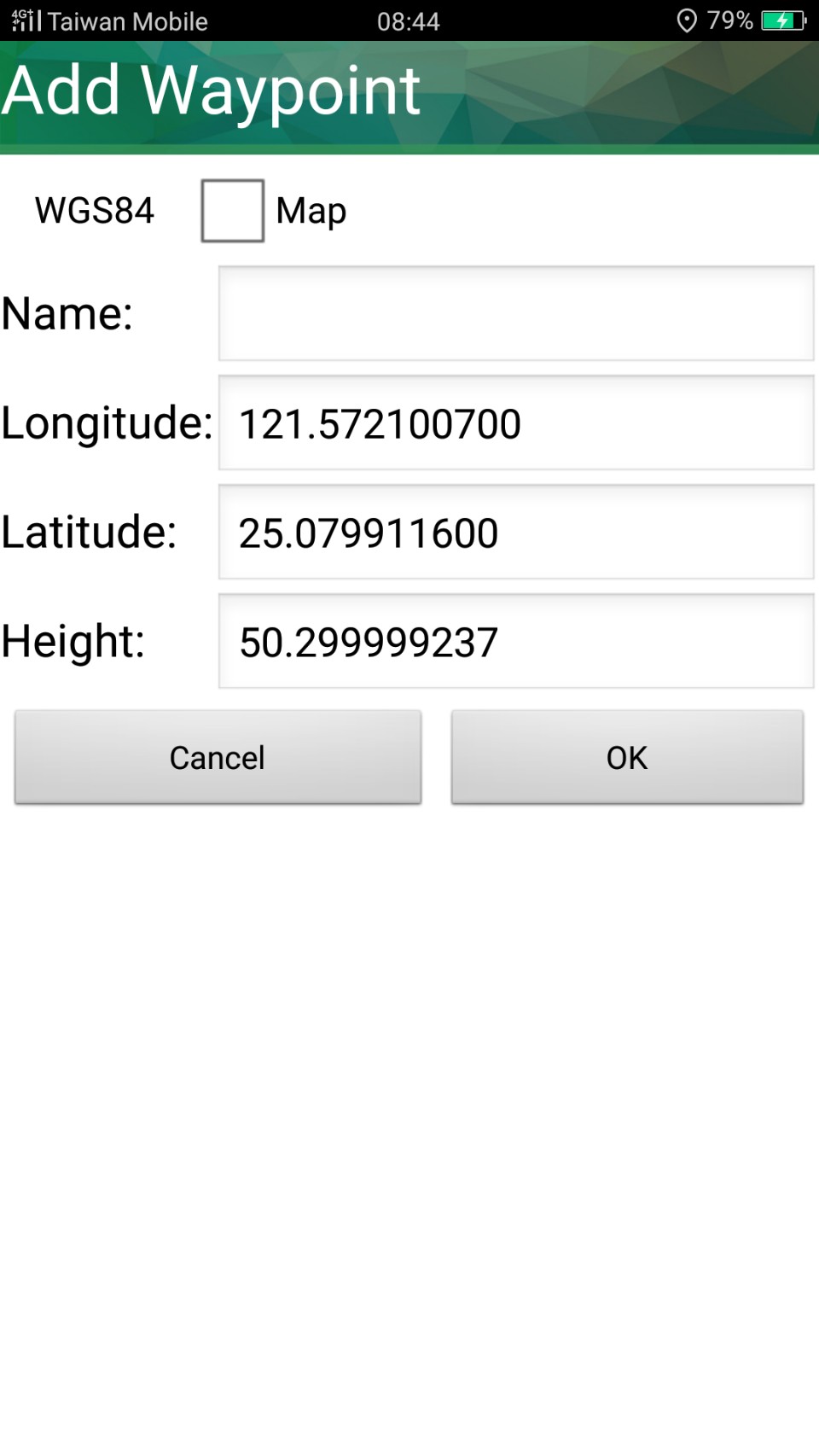
2. Tap the place you want on the map or tap ![]() to set waypoint and "Add Waypoint" window shows up, please select the coordinate system, and enter waypoint name and Z value. The coordinate fields (longitude, latitude, elevation) shows the current coordinates. You can modify the coordinate values manually. Please tap OK to finish.
to set waypoint and "Add Waypoint" window shows up, please select the coordinate system, and enter waypoint name and Z value. The coordinate fields (longitude, latitude, elevation) shows the current coordinates. You can modify the coordinate values manually. Please tap OK to finish.
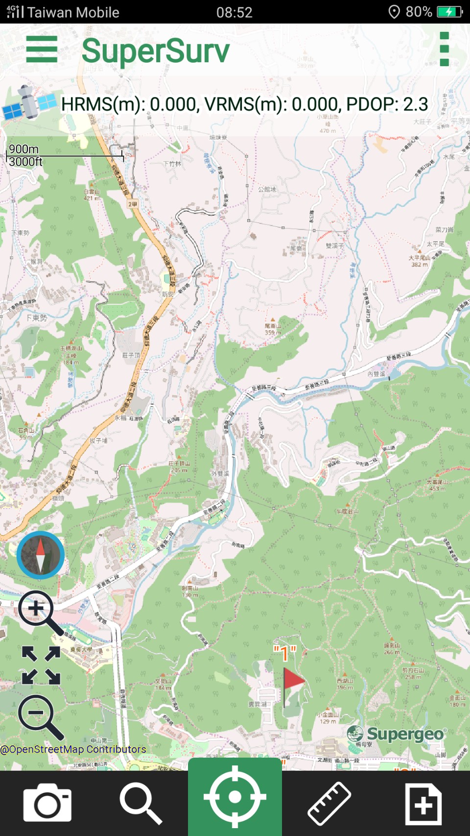
3. Waypoint is successfully added. The name of waypoint is also displayed on the map.
© 2017 Supergeo Technologies Inc. All Rights Reserved.