
What's New in SuperPad 10
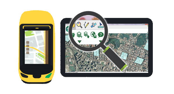
The Most Suitable Surveying Product for Windows Platform
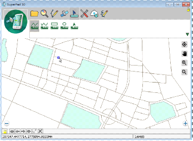
•With the growing popularity of tablet computers,SuperPad 10 supports more touch gestures. Users are allowed to use multi-touch for resizing, rotating, and panning the map.
•Redesign UI with the flat design style, which simplifies the button icons to best fit the display on tablet computers.
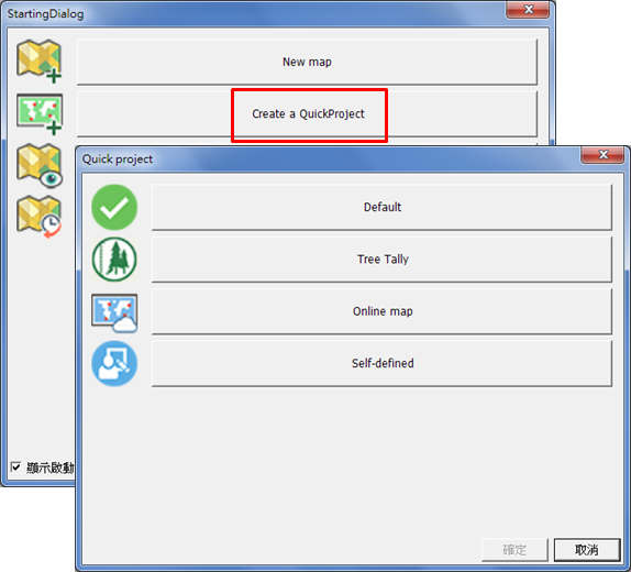
Improve efficiency with Quick Project
Provide Quick Project to improve the efficiency of field surveying greatly. Quick Project is the built-in templates designed for different domains and offers preloaded spatial data and pre-designed attribute tables to save the time of field works. It is a very practical feature when users have to create similar projects repeatedly in the field. SuperPad 10 currently supports several kinds of Quick Project, including a Tree Tally Quick Project for forest inventory, an OnlineMap Quick Project for users don’t have a basemap and the others. Users can also define and save their Quick Project if there is no suitable one for field work.
Easy to Conduct Online work!
•Enhance co-editing function with SuperGIS Server, now users can edit data in offline environment and then synchronize data back to server when under the internet environment.
•Support WFS-T, users can do online editing with WFS-T services.
•Provide WMS query function for accessing content in WMS services.
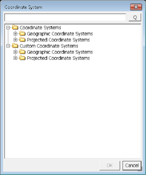
Find needed projection and datum quickly!
•Support users to find needed projections by EPSG code or projection name.
Measure X GPS
•Increase some position accuracy parameters such as HDOP, VDOP, HDOP, VDOP, PDOP, Accuracy, EPE (Horizon Estimated Positional Error) into the Alert function. When the position accuracy parameters reach to the assigned value, users will be informed. Then, users can start to collect high accuracy data.
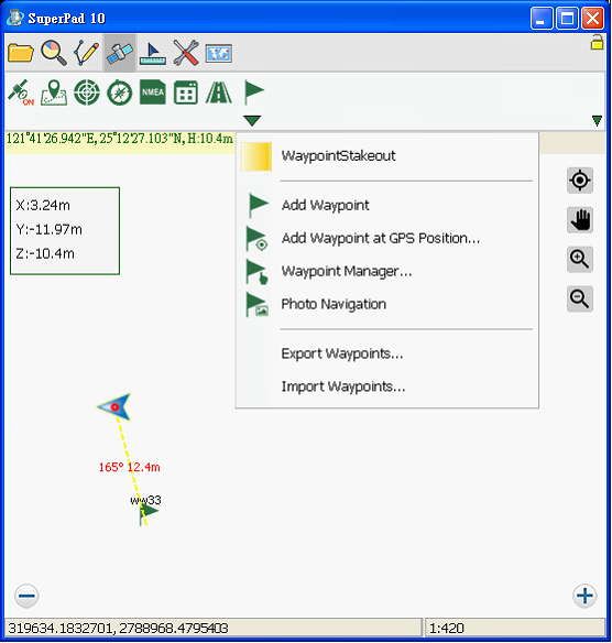
•Add stack out mode. When the distance between the target position and the current position is smaller than assigned value, SuperPad will inform users ▲X, ▲Y, ▲Z distance.
•Adjust the operation in the radial measure. Users can get the center and radius information while measuring a circle.
•Support users to apply snapping setting to multi-polyline measure. By using the snap setting, users will get more accurate measurement value
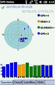
•Redesigned GPS status offers a summary of the GPS signal that's being received. It shows the reference number and signal strength of each GPS satellite that's found, and users can distinguish different satellite services by the display colors. New GPS status will assist users to access more position information.
© 2017 Supergeo Technologies Inc. All Rights Reserved.