
Setting Reference Point as Datum
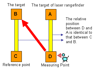
Please refer to the figure below, if a target centroid B is located where unable to measure, and the relative position between centroid C and centroid B is known identical to that between centroid D and centroid A; in that case, to get the relative position between centroid D and centroid A via laser range finder is to get that between centroid C and centroid B. After that, the position of target centroid B can be obtained by calculating with the known position data of centroid C on laser range finder. Centroid C is the reference point. Since the result is calculated by the relative position, the difference of relative position might cause that of the result.
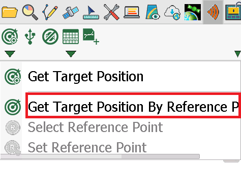
1.Tap Get Target Position By Reference Point to set reference point. Tap “Get Target Position” drop-down menu again, when Get Target Position By Reference Point shows framed by a red square, please tap Select Reference Point and directly tap where you want to set as reference point on the map.
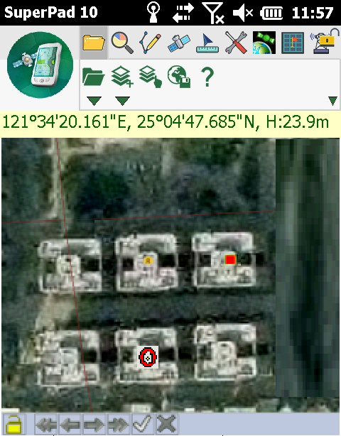
2.![]() shows up where you tap on the map, it represents the reference point. Then, aim at the relative position with laser rangefinder and press the Fire button. System will calculate and shoot a spot from datum
shows up where you tap on the map, it represents the reference point. Then, aim at the relative position with laser rangefinder and press the Fire button. System will calculate and shoot a spot from datum ![]() towards the identical relative position.
towards the identical relative position.
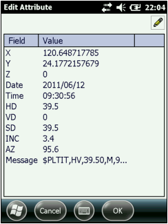
3.When the measurement result is obtained successfully by mobile device, “Edit Attribute” dialog box shows up and the attribute table will automatically be filled with results.
4.Tap OK to go back to the map, and the new feature will be added to the map.
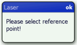
5.After tapping Get Target Position By Reference Point, if you then start to measure without setting a reference point, a message as figure below will show up to remind you to proceed by selecting the reference point after you shoot a spot.
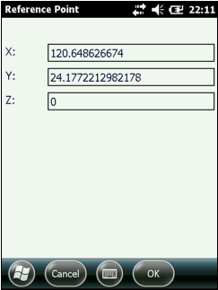
6.You can also enter the coordinates of the reference point manually. Firstly, tap Set Reference Point and the “Reference Point” dialog box shows up.
7.Enter the X,Y,Z value of the reference point. After that, tap OK and go back to the map and continuously proceed step 2.
© 2017 Supergeo Technologies Inc. All Rights Reserved.