
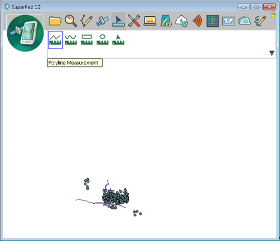
Polyline Measurement
1.Tap the System Settings button on the main toolbar, switch to System Settings toolbar, tap Polyline Measurement.
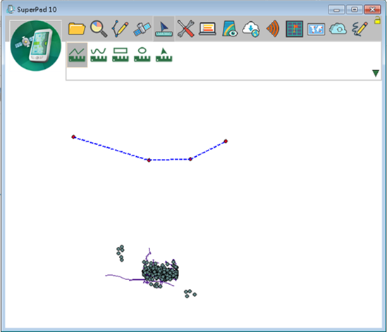
2.Then draw a polyline that you want to measure on the map with stylus by tapping on the position where you want to add a turn point and repeat. A red point appears on the first tap then a blue line appears to connect the first and second point after the second tap; after the third tap, a blue line shows up to connect the second and third point and so on. After you tap the last point, tap Polyline Measure button again to finish sketching polyline.
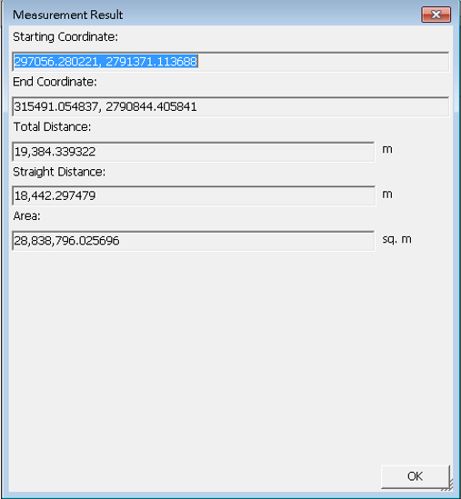
3.“Measure Result” dialog box shows up, it offers information including:
Starting Coordinate: the first sketching point.
End Coordinate: the last sketching point.
Total Distance: total distance from the start coordinate to end the coordinate.
Straight Distance: the straight distance from start to end point.
Area: the area of the closed area that is made by connecting polyline's start and end points.
 .
.
4.Tap OK to close this dialog box.
© 2017 Supergeo Technologies Inc. All Rights Reserved.