
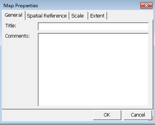
Map Properties
In Map Properties, you could set up the properties of the current map, including title, comments and spatial reference as the information for other users to better know the map.
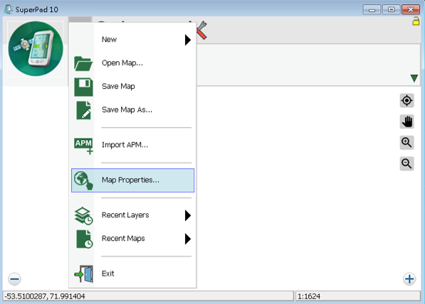
1.Tap the Map/Layer button on the main toolbar, switch to Map/Layer toolbar, and tap the downward arrow of Open Map > Map Properties.
2.“Map Properties” dialog box shows up, and you could edit the title and comments of the map in the General tab.
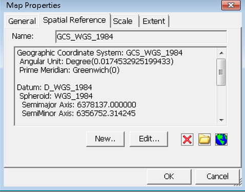
In the Spatial Reference tab and you can set the map's coordinate system. The map's coordinate system can be modified by tapping the earth button ![]() at the lower-left corner. The “Coordinate System” dialog box shows up after the earth button is tapped. Here you can set up the type of Datum or Projection.
at the lower-left corner. The “Coordinate System” dialog box shows up after the earth button is tapped. Here you can set up the type of Datum or Projection.


After selection, tap OK, it shows the selected coordinate title and details in the "Map Properties" dialog box. Or you can tap ![]() to remove the spatial reference.
to remove the spatial reference.
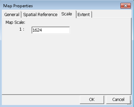
In Scale tab, you can assign the map scale.
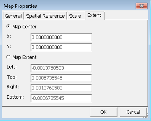
In the Extent tab, if you select Map Center, please enter XY coordinate values and the map will be panned to the extent in which the specified coordinates is the center. If you select the Map Extent, please enter the boundary values, and then the map will be zoomed to the extent with the four specified coordinates as the boundaries.
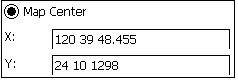
Please note that if you want to enter the coordinates in the format of Degree Minute Second (DMS), please separate the values of degree, minute and second by space. Please see the figure below, X means 120 degrees 39 minutes and 48.455 seconds.
© 2017 Supergeo Technologies Inc. All Rights Reserved.