
Map Grid
In the map grid tab, you can decide the Line and Text. Map grid will show the longitude and latitude lines on the map and indicate the value on the map.
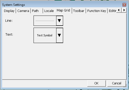
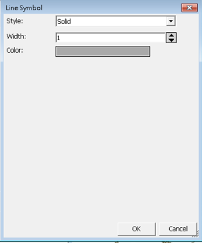
Tap Line to enter “Line Symbol” dialog, please set up for each item, including Style, Width and Color.
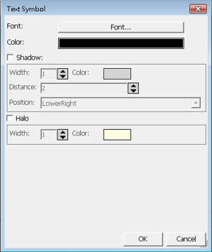
After the settings are done, continue to set up the text. Please set up according to your preference.
If you choose to show the map grid on the map, the map grid will be displayed on the map based on the settings.
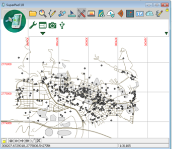
If the Spatial reference of the map is Geographic Coordinate System, and the map grid label will be presented in latitude and longitude format.
© 2017 Supergeo Technologies Inc. All Rights Reserved.