
Graphics Layer
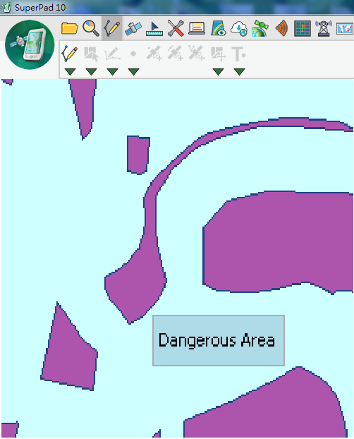
Graphics layers are to annotate the general layer with text and feature symbols to facilitate users to clearly understand the annotation information. For instance, if a dangerous area in Layer A needs to be annotated, you can use Graphics Layer to create a layer for displaying annotation on the map rather than set the attribute fields; the format is *.spg. Please see the figure below that Dangerous Area rectangle is the symbol feature of the Graphics Layer which clearly marks the location but will not influence or damage the original contents of layer.
On one Graphics layer, the various kinds of graphics including text point, text polyline, text polygon, text rectangle and text ellipse can be added at a time, and the style and text of each graphic can be set respectively. As to the way to edit graphics layer, please refer to Edit.
© 2017 Supergeo Technologies Inc. All Rights Reserved.