
GPS Status
Connect SuperPad and GPS according to the method mentioned above. Tap the GPS button on main toolbar, switch to GPS toolbar and tap the GPS Status. Then the satellite information will be displayed on GPS Status window.
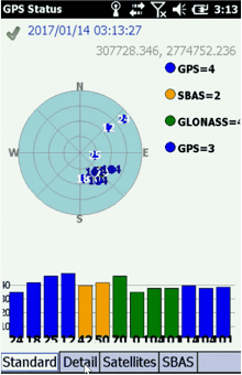
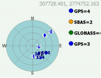
Sky illustration
|
Sky illustration displays satellites connected with the device at the current position. Each spot represents one satellite and users can distinguish the satellite services from its color. |
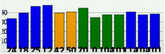
Signal Chart
|
Display the signal strength of all satellites connected with device. |
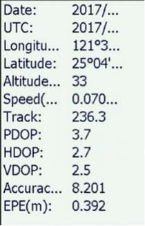
Details
|
Check GPS information in the detail tab: (1) Longitude: The Longitude of your current position. (2) Latitude: The Latitude of your current position. (3) Altitude: the height of your current position, calculated from the Sea level. (4) Speed:Your current heading speed per hour. (5) PDOP: The position dilution of precision. (6) HDOP: The horizontal dilution of precision. (7) VDOP: The vertical dilution of precision. (9) Accuracy: GPS accuracy. (10) EPE(m): A measurement of horizontal position error based upon a variety of factors including DOP and satellite signal quality. |
Satellites
Display the information of each satellite. The satellites of insufficient intensity are highlighted in pink color.
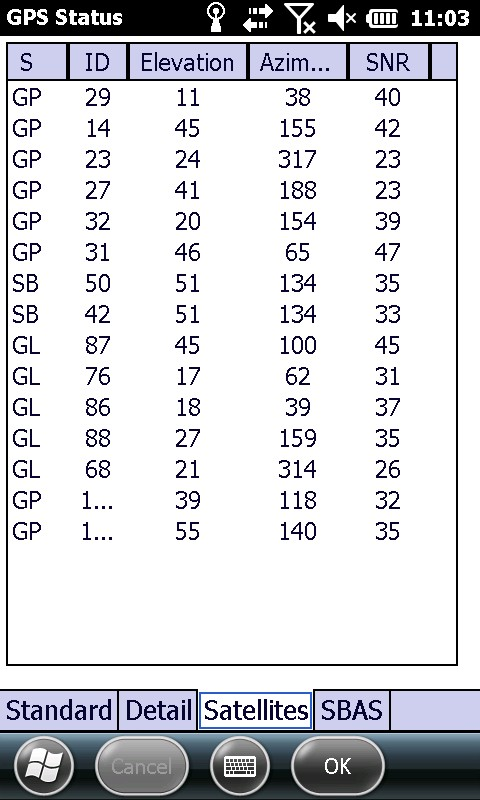
Name |
Description |
ID |
Number of satellite |
Elevation |
Elevation. |
Azimuth |
Azimuth. |
SNR |
Signal to noise ratio |
© 2017 Supergeo Technologies Inc. All Rights Reserved.