
Display
You can set the visible scale of layer in Display tab. In general, “Show layer at all scales” will be suitable for most situations, but sometimes you might need to show the major layers only, and show the minor layers at some specific scale. For instance, there are “National High Way” and “County Road” layers on the map. “County Road” layer is not very useful as the map extent covers the entire nation, and the map with “County Road” layer will make the screen more massive. On the contrary, users need to know the distribution of “National High Way” more; as a result the “County Road” layer should be hidden. While the map is zoomed to county and township extent, the county road will be needed to display, providing detail information. In such case, you can set up the visible scale to “Country Road” and display the layer as the map scale is zoomed between the settings.
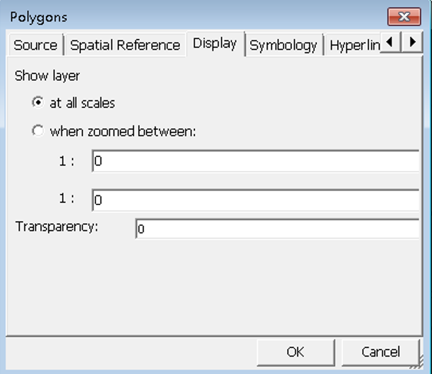
If you want to set “When zoomed between” please tick the option first and input the maximum and minimum scale. Only as the map is zoomed to the setting scales, will the layer display.
Transparency sets the transparency of the layer that the smaller the value is, the more transparent the layer is.
© 2017 Supergeo Technologies Inc. All Rights Reserved.