
Getting SuperGIS Server OGC Service
OWS published by SuperGIS Server Manager includes four types of OGC standard service(WMS, WFS, WCS and WMTS). The service files are located in the identical directory, and users can get the service through different URL. The URL of OGC service is very similar to that of regular websites, but OGC service is published as dll file or aspx file while the regular webpage is HTML. Thus, the OGC service is not able to access through web browsers(like IE) but it takes the related front-end application to make it.
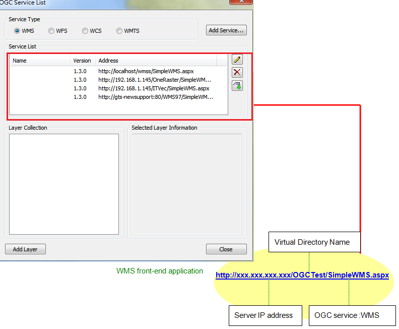
The URL of OGC can be separated into three parts, IP address of server, the name of virtual directory and OGC service. The name of virtual directory refers to the virtual directory you set when creating OWS website through SuperGIS Server Manager. OGC service differs with the service type you select, such as WMS service takes SimpleWMS.aspx, WFS service takes SimpleWFS.aspx, WCS service takes SimpleWCS.aspx and WMTS service takes SimpleWMTS.aspx.
The different OGC service takes different front-end application or interface to get the service due to the different service structure or protocol. SuperGIS Desktop 3.2, the desktop GIS (Geographic Information System) of SuperGIS series, allows users to edit, save, check, integrate, handle, analyze and display the related information of surface location. OGC extension in SuperGIS Desktop 3.2 allows to add WMS, WFS, WCS, and WMTS data. Through the service connection provided by the server of SuperGIS Server or of other OGC service, users are able to easily add WMS, WFS, WCS, and WMTS layers easily in SuperGIS Desktop.
More, users can also get the WMS and WFS service through SuperPad. SuperPad 3.1, one of the SuperGIS 3 series products, is the full-functionality mobile GIS software designed for mobile GIS and field mapping application. The field surveyors can collect, edit and measure the spatial data in field with SuperPad on the mobile devices, which improves the validation and usability of data. Above all, the DataServicesToolbar extension in SuperPad 3.1 provides the tool to add WMS and WFS layers so that users can easily add WMS or WFS layers published by SuperGIS Server or other OGC service server in SuperPad 3.1.
©2017 Supergeo Technologies Inc.