
Default Tools
Identify

For those layers set as feature services, the identify tool will pop up a window to show the detailed feature information when users click on the feature. This tool is enabled by default and all of the feature service layers are identified by default as well.
Coordinates

The coordinate tool will show the coordinates of mouse. This tool is enabled by default.
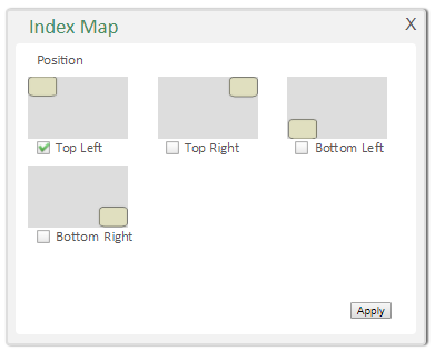
Index map

Users can choose the position of the index map to be upper left, upper right, bottom left, and bottom right corner. This tool is enabled by default.
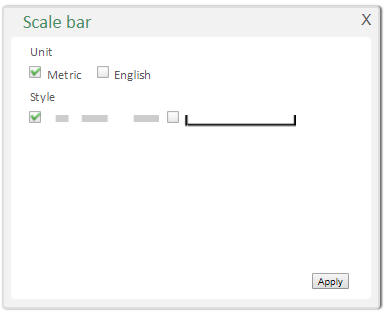
Scale bar

Users can choose the display unit of the scale bar to be English or Metric and its style. This tool is enabled by default.
©2017 Supergeo Technologies Inc.