
Setting Display Extent
Display-Keep Extent
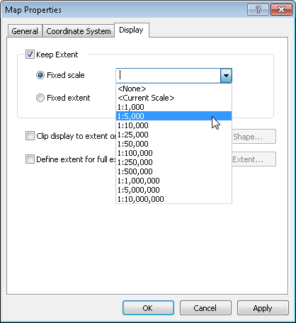
“Keep Extent” is in the “Display” tab of Layers Properties window, which defines the fixed map scale or fixed display extent. When “Keep Extent” is checked, you can decide to use “Fixed Scale” or “Fixed Extent.” “Fixed Scale” is to have the map displayed at some fixed scale that users cannot change to other scale ratios. Please see the figure below; you can select from the default scale options or enter the scale on your own.
“Fixed Extent” is to have the map display at some specific extent that users cannot change. The needed map display extent can be decided in different ways, making the map display simply in the selected extent. The extent can be set by “Current Display Extent”, “Outline of Features”, “Outline of Graphics” and “Custom.” Now we are going to describing the four types of settings.
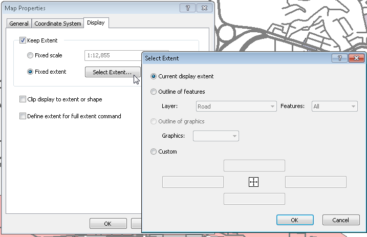
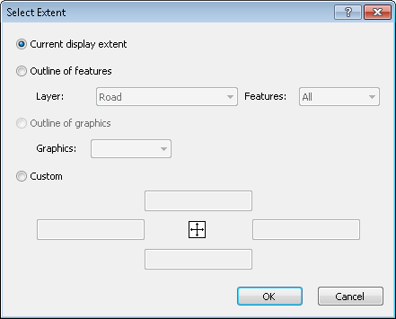
1.Select the fixed extent and click “Fixed Extent”, the “Select Extent” window pops up, the default is “Current display extent.” The system will regard the current map display extent as the fixed display extent.
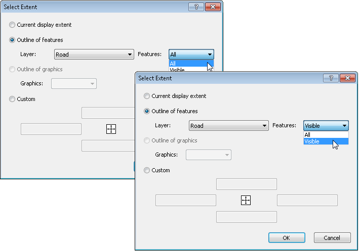
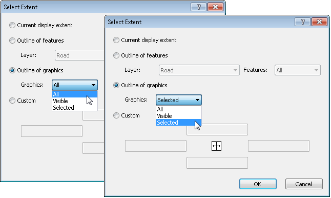
2. “Outline of Features” means to set the outline which is formed by one single feature or multiple features as the display extent. In “Layer”, all layers in current map will be listed here, and “Features” will have different options depending on there is any feature(s) selected or not. If no feature is selected, there are two options: “All” and “Visible”; if any feature(s) is selected, there is one more option “Selected.” “All” will set extent covering all features of the assigned layer as the display extent. “Visible” sets the extent that covers features of the assigned layer which are visible on the current map extent as the display extent. “Selected” enables you to select a feature and set as the display extent.
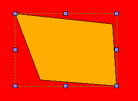
3. “Outline of Graphics” uses geometry objects of rectangle object, ellipse object and polygon object to set the extent. Like the “Outline of Features” setting, if no feature is selected on the map, the options will list “All” and “Visible.” If some feature(s) is selected, the option of “Selected” will be added.
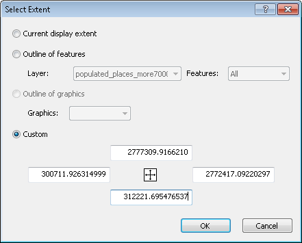
4.“Custom” allows users to set the map display extent by entering the top, bottom, left and right boundary. In addition, if you have set “Current Display Extent”, “Outline of Features” or “Outline of Graphics” in the previous use, when the Select Extent window opens, “Custom” will be checked and show the current map extent automatically.
NOTE: Once you set “Fixed Scale” in layers properties, the zooming functions (zoom in, zoom out, fixed zoom in, fixed zoom out, full extent, previous extent, next extent) will be disabled. If you set “Fixed Extent”, besides zooming functions, pan and move map functions will be disabled as well.
Display-Clip Display to Extent or Shape
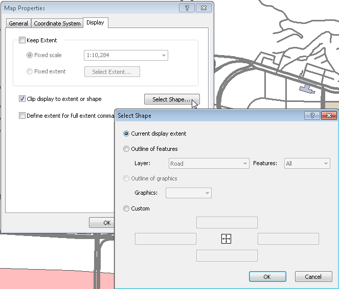
“Clip Display to Extent or Shape” allows users to clip and display the needed map extent, while the rest part will be filled with “Background Color.” Check “Clip Display to Extent or Shape”, click “Select Shape”, and the “Select Shape” window shows up, it offers four options, “Current Display Extent”, “Outline of Features”, “Outline of Graphics” and “Custom.” The setting is the same as “Fixed Extent”, please refer to “Keep Extent-Fixed Extent.”
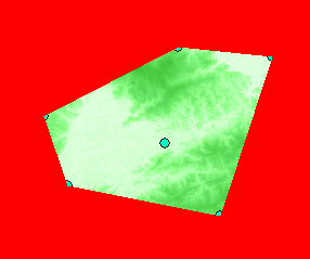
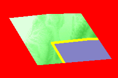
The figures below show the effect of using “Outline of Features” and “Outline of Graphics” of “Clip Display to Extent or Shape.” The red part is the background color which can be set in map background.
Clip display to extent with Point feature.
Clip display to extent with Line feature.
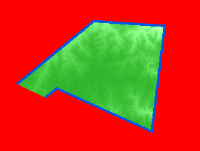
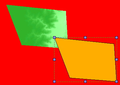
Clip display to extent with Polygon feature.
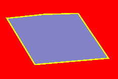
Clip display to extent with polygon graphic object.
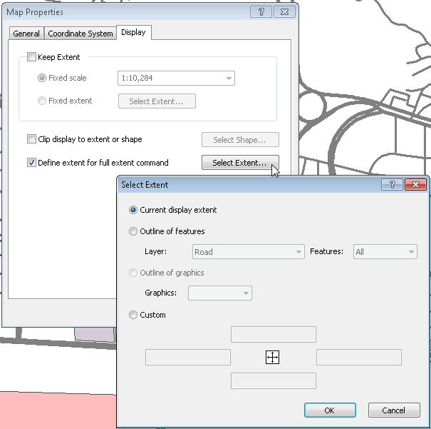
Display-Define Extent to Full Extent Command
”Define Extent to Full Extent Command” allows users to define the display extent of “Full Extent” on their own. Check “Define Extent to Full Extent Command”, click “Select Extent” and the “Select Extent” window shows up. The setting is the same as “Fixed Extent”, please refer to “Keep Extent-Fixed Extent.” After that, as long as you click ![]() , the “Full Extent” button, the map will zoom to the extent you have set.
, the “Full Extent” button, the map will zoom to the extent you have set.
©2015 Supergeo Technologies Inc. All rights reserved.