Transformation
Transformation includes rotating, shifting and scaling image, which allows users to adjust the image data to a correct angle to review. You can find the tools on the toolbar as the figure below indicates.

Rotating Image
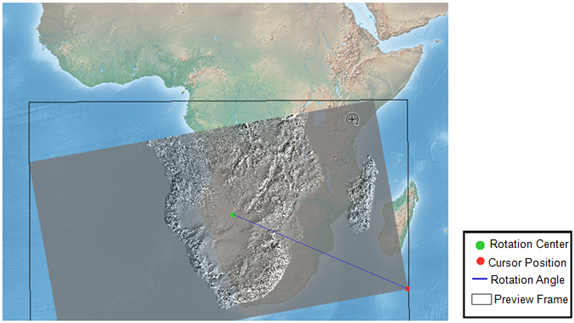
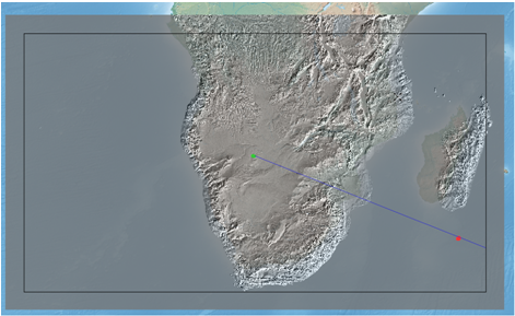
Rotating Image rotates the image to a correct view angle and makes the image georeferenced correctly to the map. To rotate the image, you need to select the image to rotate first through Georeferencing toolbar and apply Georeferencing > Flip/Rotate, the options including Flip Horizontal, Flip Vertical, Rotate Left and Rotate Right. Or you can activate Rotate Tool ![]() , press mouse left key and drag mouse on the map to move around with cursor, and a preview extent with black frame shows up as the cursor is rotating. When the rotation angle is confirmed, drop the mouse left key to update the rotated image, please see the figure as below.
, press mouse left key and drag mouse on the map to move around with cursor, and a preview extent with black frame shows up as the cursor is rotating. When the rotation angle is confirmed, drop the mouse left key to update the rotated image, please see the figure as below.

Shifting Image
Shifting image can shift image to the position you want. To shift image, you need to select the image you want to shift through Georeferencing toolbar and then use Shift tool ![]() , press mouse left key and drag the image to the wanted position and drop mouse left key, and the image will be immediately shifted to the new position.
, press mouse left key and drag the image to the wanted position and drop mouse left key, and the image will be immediately shifted to the new position.
Scaling Image
Scaling Image can adjust the image to proper scale. To scaling image, please select the image to scale through Georeferencing toolbar and use Scale tool ![]() , press mouse left key and drag mouse on the map, as cursor moves, the black frame that shows preview extent will rescale along. As the scale is confirmed, drop mouse left key to finish it. See the figure below.
, press mouse left key and drag mouse on the map, as cursor moves, the black frame that shows preview extent will rescale along. As the scale is confirmed, drop mouse left key to finish it. See the figure below.


Resetting Transformation
To cancel transformation and restore image, please click Georeferencing > Reset Transformation to restore the image.
©2015 Supergeo Technologies Inc. All rights reserved.