
How to Use Georeferencing Tool
Before using Georeferencing tool, please load the image that you want to rectify, right-click on the blank part of the toolbar to show a menu and click Georeferencing to activate the Georeferencing tool.
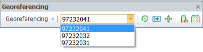
Selecting the Image to Georeference
After the image is loaded to SuperGIS Desktop and Georeferencing tool is activated, select the image data to georeference by selecting from the dropdown menu of the tool. After that, press Georeferencing > Fit To Display to rescale the image to the map extent.
Updating Image
Before start to transform or georeference you can decide whether to update the image instantaneously or by manually. The default is updating instantaneously that as any transformation or georeferencing is made, the image will be updated instantaneously; if you want to set to update image manually, you need to uncheck Georeferencing > Auto Adjust first, and the display will be updated only after Georeferencing > Update Display is clicked.
©2015 Supergeo Technologies Inc. All rights reserved.