
Land Parcel Tools
Land Parcel Editor provides users some convenient tools to understand if the parcel data matches your field survey data. This section introduces the Point Report tool.
Point Report tool reports the responding information according to the points you selected, including One-point, Two-points, and Three-points information. Click on ![]() icon to open the Point Report window. Select the information you want to know, including One-Point
icon to open the Point Report window. Select the information you want to know, including One-Point ![]() , Two-Points
, Two-Points ![]() , or Three-Points
, or Three-Points ![]() . Then click on the map to select the target point(s). Click Report to get the information; click Map Location to move the selected point(s) to the center of the map; click Clear to clear the information.
. Then click on the map to select the target point(s). Click Report to get the information; click Map Location to move the selected point(s) to the center of the map; click Clear to clear the information.
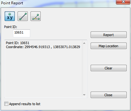
One-Point
When One-Point is selected, the reported information includes:
•Point ID of the selected point.
•Coordinates of the selected point.
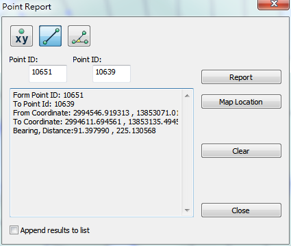
Two-Points
When Two-Points is selected, the reported information includes:
•From-Point ID (the first point selected)
•To-Point ID (the second point selected)
•Coordinates of the From-, and To- Points
•The bearing and distance of the line defined by the two points.
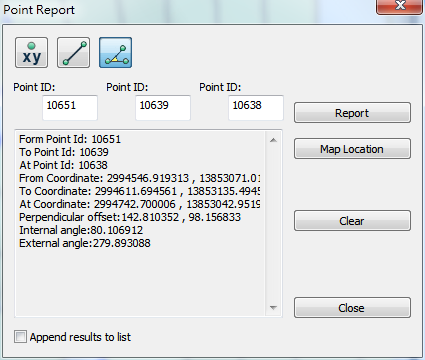
Three-Points
When Three-Points is selected, the reported information includes:
•From-Point ID (the first point selected)
•To-Point ID (the second point selected)
•At-Point ID (the third point selected)
•Coordinates of the From-, To-, and At-Points.
•Perpendicular offset of the third point to the line defined by the first and the second points
•Internal and External angle
©2015 Supergeo Technologies Inc. All rights reserved.