
Geographic Coordinate System Transformations
Coordinate system is the important property information in GIS. The different data resources have different coordinate systems, in such case, users can integrate coordinate system information thorough Geographic Coordinate System Transformations.
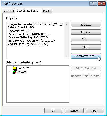
1.Click Layers to show Map Properties window and click Transformations.
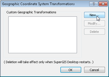
2.Geographic Coordinate System Transformations window shows up, please click New to increase new geographic information transformation.
3.New Geographic Transformation window opens, users can give a name in Name, Source GCS takes the first GCS name of the layer found in Layers from top to bottom by default and Target GCS takes the GCS name of the map coordinate system by default or users can select the required coordinate system by clicking ![]() button. In Coordinate Frame Parameters below, you can modify them by directly clicking Value. After the settings are finished, please click OK.
button. In Coordinate Frame Parameters below, you can modify them by directly clicking Value. After the settings are finished, please click OK.
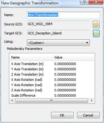
4.The new transformation setting now shows up in the Custom Geographic Transformations menu and you can modify or delete it.
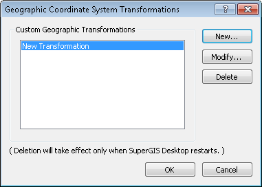
NOTE: Deletion of transformation settings takes effect only when SuperGIS Desktop restarts.
©2015 Supergeo Technologies Inc. All rights reserved.