
Arc Tool ![]()
“Arc Tool” helps users to digitize arc features on the map, which is suitable for creation of polyline feature or polygon feature. When a polyline or polygon feature is created with “Arc Tool”, the angle between any two neighbor vertices on the arc's edge would be 1 degree.
Before starting to create an arc line feature, firstly, click “Start Editing” and select the target layer. Then click “Create New Feature” and “Arc Tool.” To create an arc, you need to set the start and end vertex first, which is very similar to digitizing a line. To create the start vertex, click on the map and release the mouse and a start vertex is finished; then move mouse to digitize a straight line by clicking at the proper position where you want to set as the end point of the arc.
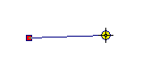
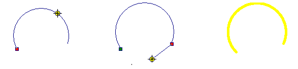
Then move the mouse, the straight line will become a changing arc as mouse is dragged; in the mean time, the mouse can move the position of any point on the arc, which will change the entire arc immediately. Click mouse when the arc is confirmed and the feature is created. After that, you can continue to create next arc or right-click to finish the sketch.
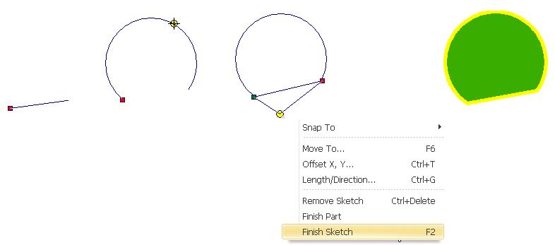
You can also create polygon feature with “Arc Tool.” Click “Start Editing” and select the target layer. Click “Create New Feature” and “Arc Tool.” Create arc polygon feature in accordance with the way to create arc line feature. Please see the figure below the digitized polygon feature, the difference from line layer is that the polygon feature will connect the start and end point of the arc, forming a closed arc polygon feature.
©2015 Supergeo Technologies Inc. All rights reserved.