
Auto Intersection
Auto Intersection calculates the possible point of intersection of two line features on the same layer and stretches the two segments to the point of intersection.
How to Use
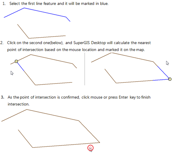
Before using Auto Intersection tool, make sure at least one line layer is added on SuperGIS Desktop in editing mode. Click Auto Intersection![]() , select the first line feature that you want to do Auto Intersection and the selected line feature will be marked in blue. Then select the second one. According to the mouse location, SuperGIS Desktop calculates the nearest point of intersection of the two lines and labels it on the map. As the point of intersection is confirmed click mouse or press Enter key to finish intersection. Press Esc to cancel intersection.
, select the first line feature that you want to do Auto Intersection and the selected line feature will be marked in blue. Then select the second one. According to the mouse location, SuperGIS Desktop calculates the nearest point of intersection of the two lines and labels it on the map. As the point of intersection is confirmed click mouse or press Enter key to finish intersection. Press Esc to cancel intersection.
© 2013 Supergeo Technologies. All Rights Reserved.