
Adding Multipoint Features
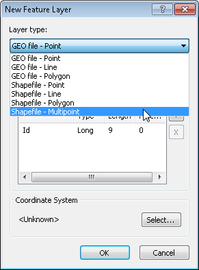
Multipoint feature means multiple points contained in a set of attributes. The method to add multipoint features is to right-click Layers in "Data Content" window, and click "New Vector Layer" in the menu. As "New Vector Layer "window is opened, choose the layer type, click "Shapefile-Multipoint", and click "Edit" in "Source Coordinate System." (The method to create a new coordinate system please refer to Setting Coordinate System). As the coordinate system is set completely, click "OK" in "New Vector Layer" window, choose the path to and name of the new vector layer, click "Save", and continue the following actions.
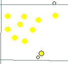
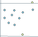
Firstly, click "Start Editing" and choose the target layer (the name of the multipoint layer is “Multi”). Secondly, click "Sketch" and "Add New Features." Then, you can click multiple point features and double-click the last point feature to finish "Sketch" (or right-click the last point feature and click "Finish Sketch").

©2015 Supergeo Technologies Inc. All rights reserved.