
Setting the Reference Scale
The reference scale might affect the display of features when the map is zoomed in/out. If you have set the reference scale, the features will be bigger when the map is zoomed in, or be smaller as the map zoomed out. Right-click Layers in "Data Content", choose "Reference Scale" in the menu, the system will set the reference scale based on the current scale of the map. If you want to clear the reference scale, you can also apply the menu and choose "Clear Reference Scale." If you want to zoom to the reference scale, you can choose "Zoom to Reference Scale."
.png)
After you set the reference scale, the features of different types of layers might be influenced in different ways. In the polygon layers, the boundaries of the polygon features will be wider or thinner as the map is zoomed in/out. The width of the line features will be influenced by map scale. The size and the width of boundary of the point features will be affected by the map scale as well.
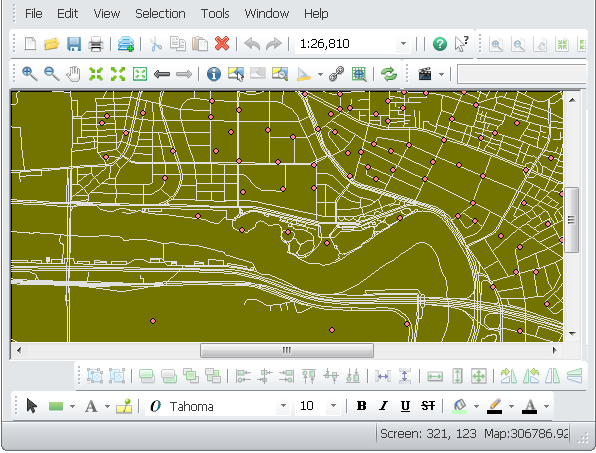
Take the map for example. If the reference scale is not set, the lines are not influenced when the map is zoomed in.
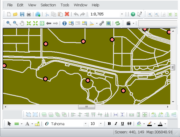
If the reference scale is set, the lines become thinker or thinner when the map is zoomed in/out.
Besides the methods above, you can open "Layers Properties" window to set the reference scale.
.png)
NOTE: The map scale will not appear ![]() when your map is not defined with map unit. So, the settings related to scale, such as “Don't show layer when zoomed” and reference scale will be disabled if there is no map unit.
when your map is not defined with map unit. So, the settings related to scale, such as “Don't show layer when zoomed” and reference scale will be disabled if there is no map unit.
©2015 Supergeo Technologies Inc. All rights reserved.