
Setting the Visible Scale of the Layer
The layer can not only be displayed at any scale but also at certain scale only. Therefore, even though the map is small, SuperGIS Desktop can prevent the case that the features are too small to be displayed clearly, or the map scale is too big for users to read the whole map or the other features might be ignored due to the big map scale. So, users are allowed to set the visible scale of each layer respectively.
In "Data Content", double-click the layer you want to set. Then, Layer Properties window shows up, and in "Display" tab “Show Layer at all scales” is chosen by default. However, you also can choose “Don't show layer when zoomed” and choose “Out beyond” and “In beyond” in the two drop-down lists. The lists contain the common scales, none, and current scale. "None' means no setting; "Current Scale" stands for the current scale in the map window.
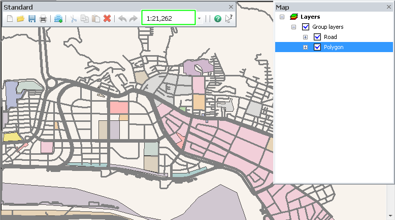
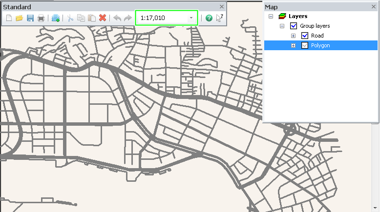
Take the point layer setting for example. The minimum scale is 1:100,000, and the maximum scale is 1:25,000. If the scale is between 1:25,000 and 1:250,000, the layer can be displayed completely. If the scale is smaller than 1:250,000 or larger than 1:25,000, the layer is not visible.
.png)
NOTE: To set “Don't show layer when zoomed”, you can only set one of the conditions.
In addition to the way describe above, you can also right-click the layer in "Data Content", choose "Visible Scale" and set minimum/maximum scale here. The system will set the minimum/maximum scale according to the current scale of the map.
Moreover, after you set the minimum/maximum scale of a layer, the mark in front of the layer will become ![]() when the map scale is beyond the visible scale. As the grey check is displayed, you still can uncheck the layer and make it invisible.
when the map scale is beyond the visible scale. As the grey check is displayed, you still can uncheck the layer and make it invisible.
©2015 Supergeo Technologies Inc. All rights reserved.