
Setting Coordinate System
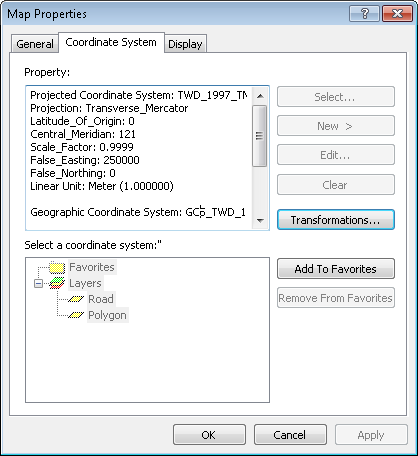
In a project, the "Coordinate System" in "Map Properties" window records the project's coordinate system, projection, etc. Users are allowed to use "Select", "New", "Edit" functions to modify or edit the coordinate system. Firstly, you can click "Select", and "Select Coordinate System" window shows up. Choose the coordinate system you need. Or you can click "Browse" to search a suitable coordinate system the folders.
.png)
Setting Coordinate System for the Layers is to make the layers of different coordinate systems overlaid correctly. If the coordinate system is not set, the layers cannot be overlaid automatically. However, if none of the layers are defined with coordinate systems, the coordinate system of the Layers will be meaningless. The coordinate system of a new map is defined as Unknown by default. If a layer with coordinate system is added, the coordinate system of the Layers will be defined as the coordinate system of the added layer.
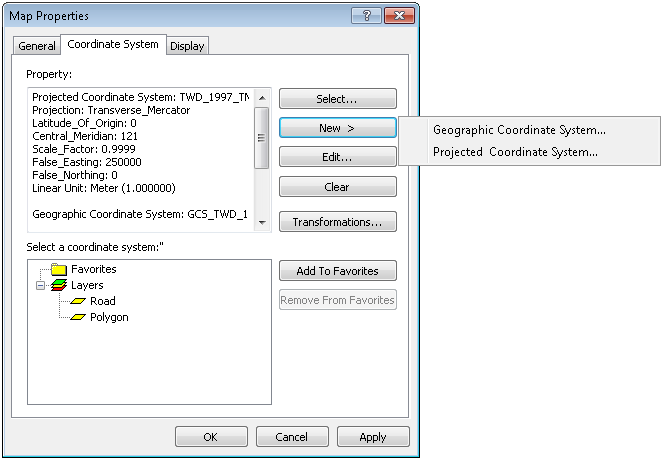
NOTE: If you are in the status of editing, you are not allowed to click button “Select”, “New”, “Edit” and “Clear” in tab “Coordinate System” of “Layers Properties” window. Moreover, you can click "New" in "Coordinate System" tab to create your own coordinate system, including the name and contents.
Besides the name, the window also contains "Datum" and "Projection." "Datum" is a mode of measuring the earth, including "Horizontal Datum" to measure longitude and latitude and "Vertical Datum" to measure elevation. The Name drop-down list provides a number of modes. Furthermore, "Spheroid" is used to display the three dimensional shape of the earth obtained by rotating an ellipse about its minor axis by 360 degrees. Users can choose a spheroid coordinate system in the Spheroid Name drop-down list. Meanwhile, you can set the length of "Semimajor Axis" and "Inverse Flattening." "Semimajor Axis" is the half length of the major axis of the ellipse. "Inverse Flattening" is the inverse flattening of the ellipse. As to the projection, users can choose whether to use "Projection" coordinate system. "Projection" uses the flat two dimensional surface to describe the three dimensional surface of the earth. Generally, "Projection" applies mathematical model to transfer the features on the surface to the positions on the flat surface. Since the earth is three dimensional, it is necessary to apply some methods to describe the map on a two dimensional surface. Therefore, after ticking "Projection", you can choose the projection coordinate system in Name drop-down list.
Compared with "New", the window, Coordinate System, appearing after "Edit" is clicked enables users to edit or modify the current coordinate system instead of creating a new coordinate system.
.png)
.png)
©2015 Supergeo Technologies Inc. All rights reserved.