
Setting Map
Users are allowed to set the basic settings of the layers in "Data Content", including the name of Layers, map comment, map unit, distance unit, display extent, map background color, layer legend, etc. That is to say, the settings in Layers Properties are used to define the display of the map rather than a single layer. There are 2 ways to open Layers Properties window:
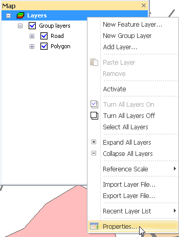
First, double-click "Layers" in "Data Content." Or right-click "Layers" and click "Properties."
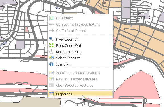
Second, right-click on the map window, and click "Properties." This way can be only used when you are not editing the layers.
©2015 Supergeo Technologies Inc. All rights reserved.